Wednesday, April 9

The California Desert, Cadiz and HMD Series Caching: Day 5

We woke up at 6:15, got dressed and got our stuff packed up and shoved into the van.  We ate our free continental breakfast of waffles, sausage and OJ.  We had light conversation and found out Jim woke up with some sort of sinus thing.

We checked out of our hotel and hit up the Safeway to replenish our water, ice, bread etc.  I went over to the beer section just to see if they had any local stuff to try.  They had some Grand Canyon Ale brewed in the near by town of Williams.  I wondered if it tastes like the Grand Canyon?  We will find out later that night.  Of course I was carded but the cashier was very surprised I was 30 and look the way I do.

We hit the road towards Cadiz and arrived at the first one around 8:15.  There was a message written in the rocks near the cache that said They Boys we turned it into The Boobs!  Haha.  I told Brenda and Ray that our name next year should be The Boobs.  Since this trail started to the north and worked its way south, we actually started at 400 and worked our way towards the smaller numbers.  That also meant we would be jumping from the opposite side of the van.  Thank you van for having two sliding doors.


Brenda jumped first while it was still coolish outside.  Ray drove, Jim navigated and I stamped.

Nothing says power trail like a good dirt road!  Our van got so filthy.


We hit our first 100 caches around 9:45, this section is where I hit my 9,000th cache milestone.  Brenda had some interesting finds including one hidden near a giant tire and one in a broken down rusty car.


It was my turn to jump so we did some switching.  It was getting warmer.  We took a break, found and set up Ray's Kindle so we could listen to some music while we cached.  The quiet dirt road was getting to everyone.  

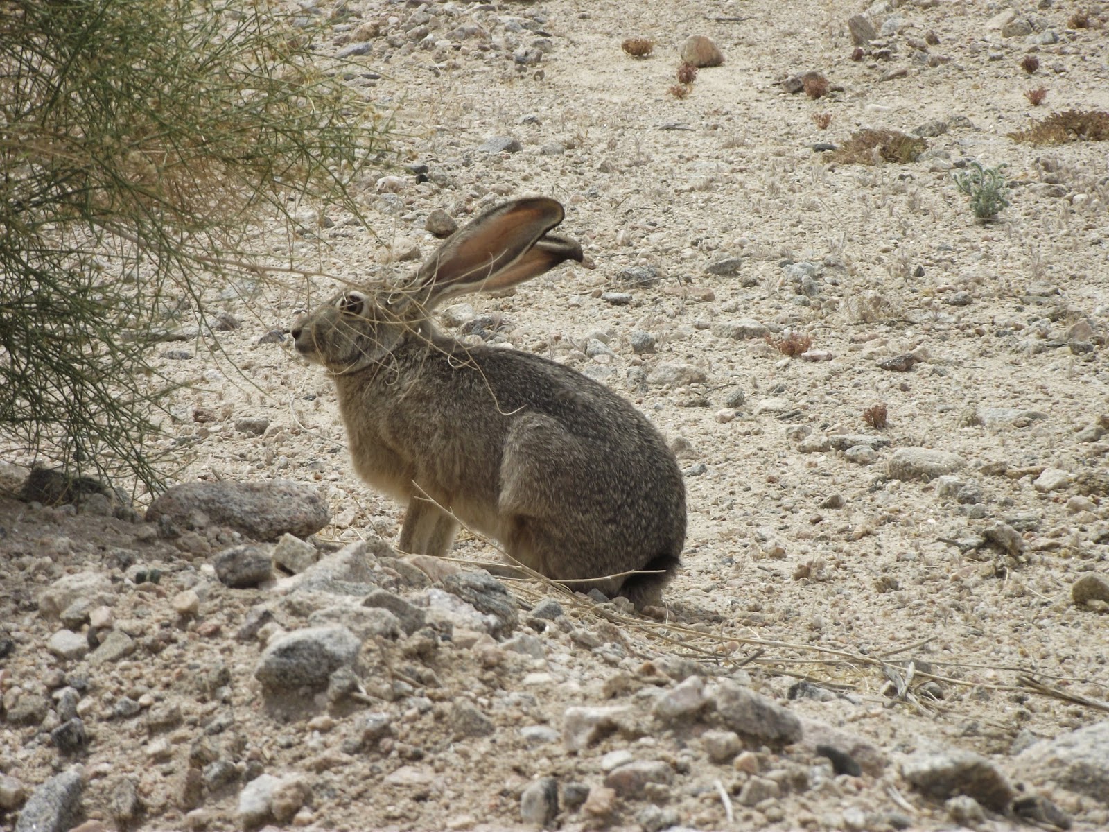
We even saw a bunny.


We managed to get through 175 of the Cadiz caches before we had to turn around.  The sand was getting really deep and we didn't know how much deeper it would get and if we did get stuck how would we get help out?  We turned around at cache #221 and made our way back to California 62.  It took an hour to get to the main road.  We stopped near the road and decided to take a lunch break before we dove back into the HMD Series.

Gotta love those PBJ sandwiches and chips right?

After lunch we got back into it.  I finished part of my 100 and Ray jumped out for his share of the caches.  I drove.  It was interesting.  I even had a epic blow by.  It was by at least 200 feet.  Whoops!


We grabbed a few extra caches in between the HMD caches.  We didn't realize a lot of the caches would not be there.  Ray and Brenda didn't bring any film containers, Jim did but not very many and I didn't bring any because I thought Ray and Brenda would so...we had to make these ones last as long as we could.


One of the extra ones was a virtual called At The Sign Post Ahead (GCHBK7) and it was pretty cool.  It had so many weird things people have added over the years on it.  I added some flare of my own.


We were up to 300 caches by 2:30 and we decided we would end at HMD #500.  It was about two hours later when we hit our quota of about 400 caches for the day.  It would be about an hour before we were in 29 Palms which was right around dinner time.  En route we all decided that BBQ sounded delicious.  We put it into Nuvi and The Rib Co popped up on the screen.

The food was tasty.  I had a burger and fries and you could see them BBQing our food from outside.  It was lucky we got there when we did because a huge group of people walked in.  We assumed they were hikers/climbers and that they have been at Joshua Tree all day long according to their shirts they were wearing.  After dinner, we stopped at the Rite Aid to check on cache containers.  We decided on some Easter eggs just in case we ran out.  On the way to our hotel we saw a mural of a roadrunner and had to take a picture with it since we were Team Roadrunners.  Yes, I am poking it in the butt.


We checked into our hotel and it had a pool and a hot tub.  You bet your ass we were in the pool and hot tub after we got all situated.  I dumped a pound of sand out of my shoes as we were taking turns taking showers after relaxing in the hot tub.  It felt great to be clean.  We talked about what we were going to do tomorrow and we all decided to grab the last 500 caches instead of breaking it up into two days.  We were going to use Friday as a sight seeing day/29 Palms caching day.  Tomorrow was going to be a long hot day.  Bring it!

Cache total:  9,227

Next Adventure:  The California Desert and Finishing HMD Series Caching:  Day 6

Tuesday, April 8

The California Desert, Lake Havasu and HMD Series Caching: Day 4

Today we all woke up around 7:00.  This was going to be more of a relaxed-see-some-things kinda day.  I got my stuff together, brought it down stairs and packed it up in the van.  We were only here for a night.  Unfortunately, the hotel was doing their remodel which meant no free continental breakfast and that's one of the reasons Ray booked the darn thing.   So now we're trying to figure out where to go for breakfast.  Jim really wanted to go to Subway but every time he mentioned it for some reason we were in a town without a Subway or there were signs for a Subway and no Subway.

We got gas first and the cheapest according to the Gas Buddy app, was across the Colorado River in the nearby town of Mojave Valley, Arizona.  It was my turn and got lucky.  The gas in Arizona was at least fifty cents cheaper than a mile away in California. I paid $3.31 for a gallon.  We drove back over the bridge into California and all put our heads together and decided on a grocery store.  There, we could replenish our bread, drinks and other stuff while we picked up some fruit, doughnuts and juice. We got onto I-40 east.  Then hit the 95 interchange south towards Lake Havasu.

I was pretty stoked I was here when we rolled into town.  It was totally summer time here and it was awesome!  When we got there, it was not what I expected nor what I remember from the last time I was here.  It was like 1986 or something and I was 3ish. 

"A young town (founded in 1963 and incorporated in 1978), Lake Havasu City was built on the spirit of possibility and innovation.  It was in this spirit that town founder Robert P. McCulloch, Sr. purchased and relocated the town's showpiece, the London Bridge, from its original location in England to its new home in sunny Arizona.  Located on the shores of Lake Havasu, the city attracts 775,00 visitors a year with its calm waters, beautiful beaches and desert weather with more than 300 sunny days a year.  Lake Havasu City is the major population center of Mohave County, with a population of 52,527 (2010).  It's easily accessible by major highways and a short drive from Los Angeles, Phoenix and Las Vegas."

http://en.wikipedia.org/wiki/Lake_Havasu

And then I saw the In-N-Out and we were so gonna go there for lunch later even if they dropped me off and wanted to go somewhere else.  But it was too early for lunch at the moment.  We drove across the bridge and I took a video of it.  There were quite a few people walking around.  There was one cache in particular we wanted to take away from here if not more if we had the time.


We parked the car in the nearby parking lot next to the bridge and made our way down to the canal.  Being seasoned cachers we sure were fooled by the elevation.  We looked for London Bridge is Falling Down (GC3X144) for a good fifteen minutes when I decided it's gotta be above us near the lamp pole.  We took some pictures and went and looked for it on the bridge.  Found it very quickly.


We decided we wanted to walk across the bridge to the other side and use the restroom and Jim stayed behind and made sure no one stole our rental van.  We took pictures of some of the plaques and statues, read up some history on the bridge and managed to make it to the restroom down below the bridge.  We goofed around the area for a bit, taking pictures inside phone booths and picking up brochures inside the visitor's center.


From the brochure:

"There have been several bridges built over the same section of the Thames River.  The Old London Bridge of nursery-rhyme fame was built by Peter of Colechurch between 1176 and 1209, replacing an earlier timber bridge.  Due to uneven construction, the bridge required frequent repair.  That bridge survived more than 600 years.  One of the more grisly periods of the bridge's history was at the southern gateway between 1305 and 1660, when it was customary to display the severed heads of traitors.  The head of William Wallace was the first to appear on the gate.  A German visitor to London in 1598 counted over 30 heads on the bridge.  The practice was finally stopped in 1660, following the Restoration of King Charles II.  By the end of the 18th century, the old London Bridge needed to be replaced.  It was narrow and decrepit, and blocked river traffic.  Designed in 1799 by Scottish engineer John Rennie, the new London Bridge was completed in 1831.  But as time passed, the new bridge began sinking at the rate of an inch every eight years.  By 1924, the east side of the bridge was some three to four inches lower than the west side.  The bridge had not been designed to withstand the impact of 20th century automotive traffic.  In 1967, the Common Council of the City of London placed the bridge on the market and began to look for potential buyers.  On April 18, 1968, the winning bid went to entrepreneur and Lake Havasu City founded Robert P. McCulloch for $2,460,000.  Each block was meticulously numbered before the bridge was disassembled.  The blocks were then shipped overseas through the Panama Canal to California and then trucked to Long Beach to Arizona, where the bridge was reconstructed in Lake Havasu City, and rededicated in a ceremony on October 10, 1971.  Including the expense for relocation and reassembly, the total cost of the bridge was $5.1 million."

The London Bridge is Arizona's second biggest tourist attraction behind the Grand Canyon.


http://en.wikipedia.org/wiki/London_Bridge_%28Lake_Havasu_City%29

We walked back over the bridge and no matter where I am there is always someone wearing a WSU Coug shirt or sweatshirt.  I happen to see a guy wearing a WSU t-shirt walking around with his family down below.  I yelled GO COUGS! and he yelled GO COUGS! back.  It was awesome.

We met up with Jim at the van and decided to grab some caches around town.  We found five but looked for at least ten of them.  This town is terrible about cache maintenance.  It was getting frustrating.

We made our way to the park next to the canal.  We were next to the beach and I decided to go wading.  If we didn't have plans I would have went swimming right then and there.


One in particular we thought was pretty cool.  It was called  The Thirsty Cache (GC2NMXQ).  It took us to an ice and water store.  It was weird to see a store that sold ice and water, but then again, we were in the desert.  We looked everywhere.  Then I got an idea.  It was underneath the tray where the water drains.  We didn't think to look there right away because we didn't think you could hide a cache inside there...unless the cacher got permission.


11:45 rolled around and it was just about lunch time and guess where we went?  In-N-Out!!  This one had a lot of retirees in it.  We didn't really have to wait very long for our food at this one...in fact this one wasn't all that busy compared to others in the past.  We ate our food in happiness.


We all decided we were done with Lake Havasu and hit the 95 south to Parker.  We saw a lot of camping, parks, donkeys, houses along the river and columnar cacti!  I've always wanted to see one in person!  I finally got my chance when we arrived in Parker.  There was a small park with these giant beasts towering over the edge of the grass.  I needed to stop and take a picture with them.  Crossing one more thing off of my list of weird stuff to do.


It was 93 degrees when we started the first part of the Heart of the Mojave cache series, this was around 1:30.  It was located on the California 62.  The road was very busy.  Ray, Brenda and I took turns jumping and grabbed around 100 each.


There were several extra caches sprinkled into the power trail.   When it was my turn, we got to a cache called Low Spot (GC24A02) and I jumped out of the car expecting a micro because no one told me it was not a part of the series.  They redirected me to a tree and I immediately saw it.  I think it saw me first.  I grabbed it and drug it out in the open for everyone to see.  This was the largest one we found the entire trip.


Around 3:00 that afternoon we grabbed 100 of the HMD caches and it was still hot.

We hit a section of road that paralleled the railroad tracks and just like Route 66, California 62 also had berms along side it.  There were tons of people's names, phrases, symbols, political and religious freedom of speech.  There was a I heart Jesus, an FU Obama and even a Will You Marry Me?


We continued down the road picking up a cache every tenth of a mile.  We saw the first sign for the Heart of the Mojave-Needles Field Office.


We grabbed about a hundred more before reaching If The Shoe Fence, Wear It (GC1JTX2).  Oh My GOD!  There were shoes everywhere!  I've seen some shoe trees and this totally trumps any shoe tree I've ever seen.


We were in awe and then made our way to the back corner and grabbed the cache.  We really wanted to leave a shoe behind but none of us wanted to part with our own.  We got back in the van and continued on.  We decided to stop near the beginning of the Cadiz Trail (where we would start tomorrow).  That would bring us to about 300 caches on California 62.  Near where we turned around, we got lucky.  I found a shoe on the side of the road to add to the fence on our way back to Parker.

We finished around 5:40 and went back to the shoe fence.  We stamped the shoe several times with our Team Roadrunner stamp and hung it on the fence.


We drove the hour back to Parker and ate food at the most convenient spot we could find.  That place was called Crossroads Cafe.  Our waitress was very nice.  I fell back into the cheeseburger and fries routine just because nothing else sounded good.  The food was pretty good and all the workers seemed like they either just graduated from high school or was doing this while in high school.  We paid our bills and had to find one more cache to make it an even number of caches found that day.  We found one very close to our hotel.

We checked in, brought our bags upstairs, took showers, did some stuff on the internet and eventually went to bed for another long day ahead of us.

Cache total:  8,833

Next Adventure:  The California Desert, Cadiz and HMD Series Caching:  Day 5

Monday, April 7

The California Desert and Route 66 Caching: Day 3

I got out of bed around 6:15, got ready to go and made sure I had everything packed in my suitcases and back pack. We ate breakfast again at the hotel lobby downstairs, this time I had raisin bread only becasue I didn't want our hotel lady to hover over us again.  Once again we watched the news and weather.  It was going to be warmer today.  After breakfast, Ray and Jim checked us out of our hotel, Brenda and I packed up the car and we were on our way to do the second half of Route-66.  We got gas at the Circle K again and grabbed some ice for our drink bags.

We left Barstow around 7:15 and made it to Route 66 cache #401 around 8:15.   We had Brenda jump first while it was still cool outside.  I stamped, Ray drove and Jim did the navigating.


About a little less than an hour into it we arrived at a cinder cone in the middle of nowhere.  I remember looking at the map before our trip and wondered if we would have enough time to stop at it.  We veered off "The Mother Road" and onto a short driveway towards Amboy Crater.

Amboy Crater, formed of ash and cinders, is 250 feet high and 1,500 feet in diameter.  It is situated in one of the youngest volcanic fields in the United States.  It is located in the Barstow-Bristol trough, a conspicuous west-northwest trending physiographic feature which approximately straddles the boundary between the Mojave and Sonoran tectonic blocks.   This field was created by at least four distinct periods of eruptions, resulting in a coaxially nested group of volcanic cinder cones.  The most recent eruption of Amboy Crater was approximately 10,000 years ago.  The lava flows consist of basalt rich in minerals of magnesium, iron and calcium.  Upon close examinations, you may be able to see minute green-colored olivine crystals.  The red color indicates the presence of ferric iron and is a result of steam on heated rocks.  Amboy Crater is located on public land managed by the Bureau of Land Management.  Its recent origin and its near perfect shape led to its designation as a National Natural Landmark in 1973.  It is located about 2 miles west from the town of Amboy.

 http://en.wikipedia.org/wiki/Amboy_Crater

When we got there absolutely no one was around.  We had the place to ourselves.  We parked as close to the walkway as we could.  We all got out and wandered up to the viewing area.  It wasn't quite the volcano we were all use to looking at especially back at home where we have peaks like Mount Rainier, Mount St. Helens and Mount Baker which loom over the horizon.   We fulfilled the requirements for the earthcache (GC17CKK) and got the other nearby traditional.  We all used the lovely restrooms before we started up on the trail again.  I got hot and pulled off my extra shirt.


We grabbed over a dozen more before we arrived in the tiny town of Amboy, Calif., which is now a ghost town.  The hotel has been closed for years as the town died when I-40 diverted traffic ten miles further north.  This town has been used several times as a filming location for various movies.  We stopped found the cache, Route 66 Message in a Bottle (GC30XKN).  The Route Beer is actually brewed in Missouri, one of the states Route 66 meanders through.

http://www.route66sodas.com/


We stopped inside Roy's for some history.  It was basically the only thing left out this far before you got to Needles.  We thought there might be some cool Route 66 memorabilia to look through but there really wasn't any.  I might have to find what I was looking for online at some point.  We looked at the maps, the old posters, pictures and they had a few post cards but not very many good ones.  Brenda and Ray bought a map before we got back in the van for some more crazy caching.  We grabbed one at the small cemetery before leaving town.  About a mile or so down the road we saw our first shoe tree.


There was more traffic between Amboy and Needles than there was from Barstow to Amboy.  We had to be really careful puling back onto the road.

We hit 100 caches at 10:55.


Around 11:30 we saw our first car that was pulled over.  We had a suspicion it was a cacher.  The small SUV had Oregon license plates on it and the two people were on the other side of the road, roughly where the next cache was, Some Low Life Stole My Cheese (GC18QD3).  Brenda and I got out and ran over to see if they were cachers.  They were and they were both from Denmark.  Ray and Jim pulled the van up closer so they could meet them too.  Their names were Team-Dahl and Poden and they were visiting the US.  They started in San Fransisco and made their way down to LA onto Route 66 for some caches on the way to Las Vegas.  It was a caching trip mixed with some sight seeing.  We introduced ourselves, told them we were all from Washington State and we were here to do the power trails in the desert.  They had a trackable "guest book" that they bring with them to have cachers that they meet sign it.  We put our names in their book and grabbed the trackable code.  They took pictures of us and we took pictures of them.  It was fun to meet cachers from another country, especially those who spoke very good English.


We continued up the road towards Needles, getting a cache every tenth of a mile.  We passed the northern half of the Cadiz power trail and decided to start it from the southern route in the next few days.  During this section we actually had a DNF but chose not to log it because the description of where it was in a huge pile of rocks was absolutely terrible!  We looked too long and decided to continue on the road.  It was rather frustrating.  When it was my turn to jump, I grabbed a piece of Route 66 to bring home with me.


We made the turn and we soon found ourselves on the most desolate part of Route 66 and I was jumping.  I got pretty worn out in the heat and was getting very hungry.  We stopped at the nearby "kiosk" which was like a rest stop...or used to be a rest stop.  It had plaques to read and a small sliver of shade to eat our PB sandwiches in.  One of the plaques said:

"This section of road was one of the toughest - searing summer temperatures averaging 100 degrees and little water.  A trek across the daunting Mojave Desert could take two days in the 1920s.  During WWII this area was part of the Desert Training Center/California-Arizona Maneuver Area, established in 1942 by General George S. Patton, Jr.  Right here you would have seen the massive armada of Patton's tanks rumbling their way through the desert - and probably been delayed by passing troop movements.  Early alignments of Route 66 paralleled the railroad tracks to avoid steep grades.  Many towns along this stretch of the road began as railroad water stops and blossomed with small businesses offering hospitality and vital services to travelers.  Communities such as Essex, Cadiz Summitt, Chambless and Amboy have been home to one-room school houses, train depots, cafes, motorcourts, gas stations and campgrounds.  Most are closed now but here and there are remnants of the highway's past glory."

http://en.wikipedia.org/wiki/U.S._Route_66_in_California

We got back on the road around 1:00 and I finished all the way to #200 for the day and then Ray jumped while I drove!  OMG!  My first attempt at power trail driving.  BAM!  I aced it.


We drove through several ghost town communities that suffered from the I-40 freeway.  You could see how Essex and Goffs flourished during the 1950's when we drove past an abandoned school house and several dilapidated buildings.

At 2:45, we hit our 300 caches for the day which gave us a grand total of 700 for the trip so far.  A little while later we switched our jobs.  Jim had an epic navigation fail at 4:00 and shortly after Brenda used the first F word.


We finished all 800 caches on Route 66 around 4:30 and decided to grab the extra 40 or so that other cachers have left since 2011.


We completed the extra caches around 5:30 and got onto I-40 towards Needles.  We were all hungry and decided we wanted BBQ and while driving around we found a place called Porky's.  We were so excited.  Upon getting out of the van and getting ready to go in, a customer came out and told us that only the bar was open and not the restaurant because there weren't enough cooks.  We were devastated and annoyed we had to find another place.  We Nuvi'd the area and came up with The Wagon Wheel.  We walked inside and found a place to sit.  We were handed a menu and this was written on the cover:

"The Wagon Wheel building was originally built in 1955 as Lynn's Broiler & became The Wagon Wheel restaurant in 1978.  Our homemade food, our historic Route 66 location & of course or longterm employees have made Wagon Wheel a favorite with locals, travelers & truckers.  The Wagon Wheel staff welcomes you to Needles, California.  Thanks for visiting us at The Wagon Wheel."

I had chicken strips and fries and washed it down with a Dr. Pepper.
 
We checked into our hotel, showered, internetted and I talked to my mom and Ben from the warm balcony outside.  It was still 80 degrees at 10 p.m. and it was amazing.  It made me miss summer nights around the campfire with friends.

We put our stuff together since we were only going to be here for a night and didn't really feel like doing it when we got up in the morning.  Brenda fell asleep reading her Kindle.


We all finally passed out around 11.

Cache total:  8,533

Next Adventure:  The California Desert, Lake Havasau and HMD Series Caching:  Day 4