Sunday, December 19

TRY Rails to Trails Winter Stroll

I got up, ate some food and did some chores around the house and decided I wanted to go get a few caches on the trail.  I talked mom into going with me just for some company.  She really didn't care about finding them...more that someone was with me while I was out finding them.

It was a cold December afternoon so we bundled up.  I grabbed my backpack with all of my trading trinkets, GPS, notes, magnets, etc.  You never know what you'll need or what you'll encounter.  I put 5 caches on the GPS.  I figured that was plenty for the day.   I was trying to get to 100 caches before December 31st.  I had 12 days to get about 50 of them.  I had to go out every day and get at least 4 of them.  Game on!

We jumped into the car and drove out towards Tenino.  The first one was called T.R.Y it.  You'll Like it! (GCPNAR), which basically stands for the Tenino Rainier Yelm trail.  There was a pull out off of the 507.  We fit the car inside the spot and walked the short distance to the cache.  It was hidden amongst a bunch of small tree trunks.


We got back inside the car and blasted the heat.

The next one was off of Military Road.  We parked in the small lot off of the road and made our way to In Basalt's Shadow (GC1M4MZ).  The GPS took us to the opposite side of where we actually found it.  It was a nice view of Hwy 507 down below.  When we found the cache, it was so wet, we couldn't sign our names.  I even dumped water out of the container.


We walked back to the car and drove back towards Rainier to find the next one, McIntosh Lake (GCPMVC).  This is a very busy spot during fishing season.  You will always find a bunch of cars and trucks parked in the pull outs.  We found the closest pull out, parked the car and carefully made our way down.  The hill was very compromised, one wrong step and you could slide down the hill and hurt yourself.  We got to the trail and followed the GPS to where the cache was suppose to be.  We found it within a few minutes.


We walked further east on the trail to Trails to Rails 1 (GC1M4MJ) and found a micro hanging off some rail road ties that someone had nailed into a tree.  It didn't take us long to find it.  We walked back to our car up the muddy hill and found the nearest driveway to get to Cajun Tree (GC1KZR7) without having to walk really far.  It was getting colder by the minute.

We had a tough time looking for it.  Back and forth on the trail we looked from side to side, under and over, up and down...nothing.  Then I saw this tree.  It had broken and fallen towards the trail.  For some reason I was compelled to look under the trunk and there it was!


We walked back to the car and went home to get warm.  I had gone with Grandma a few days ago to Gerrit's Greens to pick out our Christmas tree.  When we got home we decorated the tree and wrapped a few presents to stick underneath.

Next Adventure:  TBA

Thursday, November 11

My First GPS, a Garmin Rhino 110

I desperately needed a GPS.  Writing the information down on pieces of lined notebook paper was getting old.  Plus there are sometimes I couldn't find the caches based on the hint and what other cachers wrote in the logs alone.  I had to make my time finding caches count.  I couldn't spend anymore hours looking for just one. 

I had some extra money for my birthday so I started looking for a GPS on eBay.   I couldn't get one of the good ones just yet so I settled on a bright yellow Garmin Rhino 110.  It was less than $150 and a great starting point. 

I received my GPS in the mail on November 10th but didn't get the mail until the 11th.  I immediately learned how to use it and finding caches was way more easier and quicker.  However, the maps were very hard to see and you really couldn't put a query on it because I didn't have the cords or the software and I was okay with that.  I was learning.  Instead, I had to manually input the coords into the GPS, it still was tedious but it was quicker and more efficient than the way I was doing it...without a GPS altogether.

I found 50 without a GPS and managed to double my total of finds within 2 months of getting a GPS.

I went out for the first time to grab a cache out on Rainier Road, The Elusive 80 Acres (GCRBBH) by Frisbee'r.  I parked at the given coords but never felt like I wasn't on Fort Lewis property.  I tried to hurry just so I wouldn't get into trouble.  It was my first time navigating with the new GPS so it took me longer than it should have.  When I did get to within 30 feet of the cache I knew I was in the right area based off of the hint.


I was so stoked!  I actually found a cache with a GPS!  This is awesome!  This is the start to more great adventures to be had.  Who knows what's going to happen, the people I will meet and the places I will go.  I can't wait!

Next Adventure:  TBA

Thursday, October 14

New Camera: FUJIFILM FinePix S1800

I've needed a good camera for years.  These small compact ones just won't do.  I've gone through three of them since I got a digital camera was about 8 years ago when first attended college.  Mom wanted to see all the fun stuff I was doing...this was pre-Facebook.

I got up late, ate lunch and took care of the chickens.

I went to the district office and applied for the middle school basketball job.  Then I went to Yelm post office.

Mom got off work and we went to Lowe's for some rental supplies, Shopko, Top Foods and Safeway.

While at Shopko they were having really some good deals in the technology area of the store.  I went over and looked at the different cameras.  The one that stood out was the FUJIFILM FinePix S1800 and it was only $160.00.  It was originally $260.00.  I thought about it for a few minutes and went out and purchased it.  I now owned a pretty awesome camera.  I also bought a SD memory card.   I took it home and immediately started taking pictures with it.


It's taken some really good pictures.  Now I need a tripod.

Next Adventure:  TBA

Friday, August 20

Mt. St. Helens is an Ashhole (8.18-20.10 Hike)

About a month ago, Lindsay, who is trying to get her credentials to be a hiking guide, asked if I wanted to take a hike around Mt. St. Helens. Being a fan of Mt. St. Helens, I said yes without realizing how brutal it was going to be. She had this guide book, which was outdated, last published in 2003, that showed different hikes around the cascades. She was interested in this one because it was an easy one. Which later on we figured out it was one of the “easier ones” in the book. A lot of the hikes were over sixty miles or more, with serious height in elevation. When we got back from the two-day hike, I looked on the internet of the reviews it was given. It was a 7/10 difficulty rating and was for experienced fit hikers. I was like; I survived a forty mile hike without realizing how hard it actually was. Don’t get me wrong, it was difficult and I wanted to die six miles into it but I did it and that is an accomplishment. I would probably never do it again at the spur of the moment. It was a good thing I was in somewhat shape or I wouldn’t have made it all the way around.

I met Lindsay at South Sound Running, where she works. She got off at 7 p.m. and had me bring all of my stuff with me so we could just leave from there. We headed down I-5 and made it to the Woodland exit. We stopped at the Safeway to use the bathroom and to get a few snacks. I found some Orange Capri’s Suns, a rarity at the grocery stores. So with the Capri’s Suns and some Nutria Grain bars, I was set for the evening. We headed towards Cougar, the last town before you get to the National Park. It was getting dark fast. We made it to the June Lake parking lot and set up the tent in the dark while we waited for Shawn, Lindsay’s friend from the Olympia Mountaineers.

We set up the tent, rolled out the sleeping bags, mattress pads and situated ourselves before we each took a turn using the forest as a bathroom. While Lindsay went potty, I brushed my teeth and looked around the parking lot. When she was done, we switched. We got situated in the tent when we heard Shawn drive up. He got out and got his stuff ready and we all fell asleep just before midnight. I was tired so I instantly fell asleep.


We woke up around 6 a.m. because Lindsay didn’t hear her alarm go off and to foggy surroundings and started packing up our stuff and decided what we wanted to leave behind to keep our packs light. I ate a cereal bar before embarking on our 17 miles + journey. I wish we could have seen the landmarks around us that morning but everything was too foggy. We walked the 1.4 miles to June Lake. On the way Lindsay decided to share one of her metal walking poles with me (kind of like ski poles) as we walked. We arrived shortly at the lake and admired how tiny it was. We kinda saw the waterfall but the fog was too much for a decent picture. We decided we would wait until we came back. We walked up to the trail head and off we went on the Loowit Trail. The walk didn’t seem all that bad, we rose in elevation from 3,400 to 4,800 feet and hit a couple of steep parts of the trail; nothing I couldn’t handle. We made it to the Muddy River and decided to fill up our water bottles with the filter.


We packed our stuff up again and headed towards Ape Canyon and Pumice Butte. Because of the fog, all of the plants and trees were wet. As we walked through them on the trail, our pants and shoes got soaked. I didn’t have that great of shoes to begin with so I suffered more as we walked on. We reached the Plains of Abraham, a 2.1-mile moonlike expanse. It was the flattest part of our hike. The fog started to dissipate as we reached the East Dome of Mt. St. Helens. We stopped to admire and take a few pictures before hiking on to Windy Pass. We could see Mount Adams and Mount Rainier in the distance as we walked on.


We hit mile 7, and a switchback up to 4,900 feet to Windy Pass. We definitely know how it got its name. It was so windy up there. We walked down towards the blast zone, a restricted research area that does not allow you to camp there, so we had to make it to the Toutle Trail to camp for the night. At this point, I was miserable. I was tired, my feet were starting to hurt and my shoulders were not used to the extra weight. But I knew it would happen. It started getting warm and dry. As we entered the blast zone, you could see ash, pumice and rocks for miles. Every time you breathed in, you breathed in remnants of 1980. You could see Spirit Lake in the distance.


We took a small snack and water break before we branched off and took the 1.9 mile side trip to Loowit Falls. I really didn’t want to go but I was a good sport and went with them up the trail to the falls. As we walked I gave them some information about the 1980 eruption of the volcano and they wondered how I knew so much about it. For example, I told them all of the land we were walking on at that point used to be the north flank of the mountain before it erupted and caused the largest landslide in North America.


From Loowit Falls to our camp site was probably the most grueling part of the hike. It was a seven miles and poorly marked. Several times we had to create our own path, there were many wash outs and many obstacles we had to over come. There was one creek, I can’t remember the name, where we spent a long time trying to figure out a place to cross and after my shoes dried, I got one of them wet crossing the blasted water, great more friction of the socks and more blisters. We saw a couple herds of elk as we hiked through the barren terrain.


Another time, we made it to this huge valley and had to basically make our own trail up; there was barley enough ground for the width of your foot going up. A wrong step and you tumble down…a long way. We got closer to the tree line, where the blast zone ends and the Toutle River Trail begins.


I saw the trees and I knew we were getting closer to food, rest and taking my shoes off. We made it to the cliff of the Toutle Trail head around 7 p.m. and decided to stay on the cliff. We wouldn’t have made it down to where camp was supposed to be. None of us had enough energy and want to go down to the valley. We found a place to set up camp, it was right on the northwest side of the mountain and technically still in the blast zone. We knew the mountain wasn’t going to erupt and we also knew no one was going to tell us to leave.

We were far away from civilization. It was a very beautiful spot. Throughout the set up of camp, we could hear rocks and rockslides crashing down the sides of the mountain. We heated up some water with the small camp stove and the fuel we brought with us. Shawn and Lindsay had some soup and I had my ravioli MRE. After scarfing that down, I did some surgery on my poor feet. I had a blister or going to be a blister on every single toe. I put my feet up on my pack as I laid in my sleeping bag. Lindsay and Shawn put together their sleeping arrangements and we just laid there talking as it got darker and darker. Lindsay and I said once we got back to the car we were going for hamburgers on the way home. Finally we were so exhausted we all passed out before 9 p.m. You could hear the wind howling through the flaps of the tent as well as rocks sliding down the mountain side. Other than that, you didn’t hear a thing. No birds, no animals howling, just nothing. An eerie silence when the wind wasn’t blowing. I tossed and turned all night. At one point I heard Shawn snoring and Lindsay talking in her sleep. Other than that, it was a pretty quiet night.


We woke up on our own accords because Lindsay didn’t hear her alarm go off. Shawn and I heard it but we just ignored it for more sleep time. I got up because I wanted to get a start on the day so we can get back to the car, about 11 miles away. Lindsay and I started packing up our sleeping gear while Shawn just laid there in his sleeping bag. I got out of the tent and it was beautiful outside. It was just reaching dawn as I took a picture of our tent with the mountain in the background. It’s my favorite picture of the entire trip. Shawn finally got up. I had a snack before we headed down to the Toutle River valley. It was way too early to be hiking my body made sure I knew that. Once we reached the river, where we should have gotten water, we had to climb down and climb out on really steep cliffs.


When we got to the trail head it was up for a couple thousand feet in elevation. I was dying. What a way to start out the morning. I was quickly running out of water too. For the next 5.6 miles, the trail went up and down in elevation and there were many wash outs, without water in them. We finally reached Butte Camp trail head, where we took a break, really worried about the amount of our water.


For the next 3 miles, we scrambled over lava fields and we were desperate, almost losing hope in finding water until we came to an open area. We stopped to listen. I didn’t feel the wind blowing, OH MY GOD, WATER! I have never been this thankful in my life for water. We hustled down to the water source and our spirits instantly rose. I believe the water source was called Swift Creek.


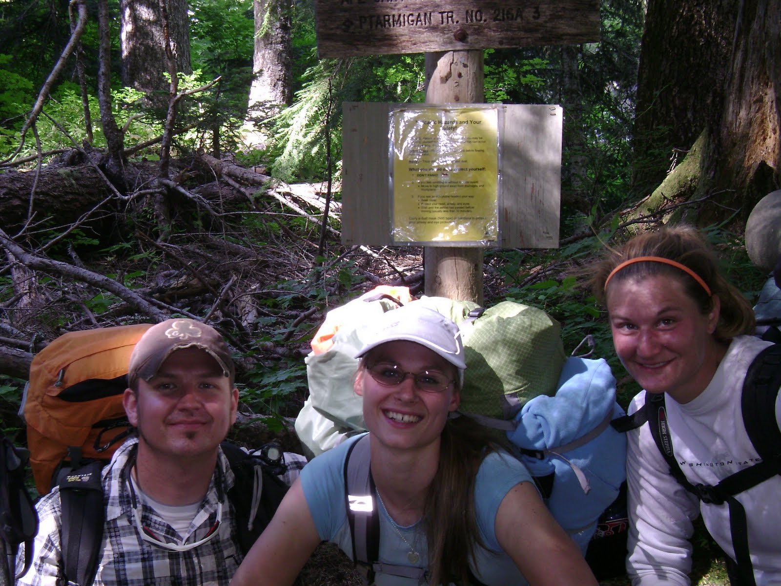
We went over several other lava fields and we could see Mount Hood in the distance. I knew we were getting closer to the south side of the mountain, where the car was. We passed Climber’s Bivouac, the trail that leads you up to the top of the mountain. We hit a grassy meadow and continued through the forest where we dropped in elevation all of a sudden, which was really hard on my knees. Once we finished that portion of the trail, we had about a mile or so back to June Lake. We hit a few more lava beds and entered the forest again as we steadily dropped in elevation towards the lake. We finally hit the beginning of the Loowit Trail head, where we began the journey around the mountain. We took a picture with the trail head sign before I basically ran down the trail to June Lake.


We posed for a few pictures with the lake and the waterfall before heading to the car in the parking lot. I basically ran the entire 1.4 miles back to the car with my 50 lb pack on. I could not wait to take my shoes off and sit. I could not wait for that hamburger. I was so hungry. I threw my pack down and took my shoes off as fast as I could. I dumped water on them because they were covered in ash. My entire body was covered in ash. About 10 minutes later Shawn and Lindsay show up around the corner. We pack up our stuff in the car, we said bye to Shawn and we left the parking lot and headed towards Cougar.


We got out at the Mt. St. Helens sign to take a picture with it and again in Cougar to get a picture with the sign since I am a WSU Cougar. We headed up I-5 and stopped at Harold’s Burger Bar in Centralia, where we literally inhaled our food. I had Doug come get me at exit 88 to go home because Lindsay was going to her grandpa’s house in Lacey to get her dog. I just wanted to go home, take a shower and go to bed. That’s one adventure to last me a lifetime.


Note to people wanting to do the hike: Do your research before you go!!

It’s the beginning of September and my feet are still healing. I couldn’t wear shoes for an entire week after our hike.

Tuesday, August 17

Seaside 2010

In April, during the softball season, the girls mentioned that they would like to do some sort of trip with all of us. They wanted to go to Seaside, Oregon. I told them I would do it but they had to plan it. Months went by and I got on them every so often to remind them to talk to everyone and decide on a day. They wanted to do it in July but didn’t know what day. Knowing them, they took care of it the day before we had to leave. I knew that would happen. Mikaila frantically found a hotel online with her mom in Seaside because we were originally going to get one in Astoria. Before that, we were trying to find a camping spot near Seaside. Yeah, campgrounds are hard to find on the Oregon coast. Lots of day use parks but not a lot of campgrounds. Thank god for her mom. She booked it for us the two days before we left.


While I was at work, I got a text message from Ashley, telling me that her mom needed to call me. I kinda got scared. Her mom is intimidating. She just called to give me directions because I had to go get Ashley from Elma. I originally thought she was going to meet us at Rochester; instead we had to go the way I really didn’t want to go. After I finished with work, I hustled over to the Stancil’s house. Thank goodness everyone was there and we didn’t have to wait a long time. I started packing the car and Erika had arranged where we were going to stay so she gave me the details. I paid her my share of the hotel room and we rounded up the gang. We stopped in Rochester because none of them had eaten and I hadn’t either (I’ve been up since 5:30 a.m.) and I was starving. I got a happy meal and we continued on to Elma. The directions to Ashley’s were actually easier than what her mom had made them sound. We told her to hurry up and put her stuff in the car so we can get down there. We got back on the road and headed towards Raymond, on Hwy 101.


A few miles down the road we got stuck in traffic. Figures. About fifteen minutes later, we were driving again. The drive seemed to go on forever and they had the music up really loud. I knew this day was going to be long. We made it to the Astoria Bridge. I didn’t realize the bridge was 2+ miles long. It took forever to get across it. The girls were getting excited because we were about twenty minutes away from Seaside. We got stuck a little bit in traffic but managed to get out of it quickly. After weaving our way through Seaside looking for our hotel, we finally found it. We even got honked at because I thought we were going down a one-way street. Oh well, no one died. Kara came in with me to check us in. They had me sign some paperwork and the lady gave me a couple of room keys. We were the room on the corner. We grabbed our stuff and went into the hotel room. The room was TINY! I couldn’t believe a room like that was over $100. The room was definitely for two people instead of five. We managed. The girls got ready, whatever for, I don’t know and we walked the Seaside strip for a while. We met up with some of their friends that they’ve known for awhile because of a previous basketball tournament and had them take us to the Taco Bell for dinner. Afterwards, we spend a couple hours at the beach. Ashley and I made a sandcastle, Kara and MiAna were in the ocean getting wet, it wasn’t the warmest weather while we were down there, and Mikaila was back and forth between the ocean and us doing the sandcastle. Ashley and I went back to the room and we brought out the soccer ball. We continued to hang out at the beach until everyone got cold. They changed and we walked around the strip again. It was around 9 p.m. and they were hungry again. We met up with them at the Pizza Hut. We hung out for a while and then we went back to the room. They said their goodbye’s and they went home. Then we walked around the boardwalk and the strip again. We got bored and went back to the room. At this point I was really tired. I started putting my bed together. Ashley and I slept on the floor and MiAna, Mikaila and Kara shared the bed. We put our pj’s on, brushed our teeth and chilled. I got on the internet for a bit while the rest of them watched some TV. I fell asleep instantly. Apparently, I got up around 3 a.m. and used the bathroom…and I told Mikaila to turn the TV off because it scared me. Haha, I don’t remember saying that. Then Kara’s Ihome went off and Mikaila yelled at me to turn it off. I didn’t even hear her because I was so tired. She got up and turned it off. I did hear it the next time it went off and I just reached up to the table and hit the button.


We all didn’t get up until about 10:45 that morning. Kara and MiAna called the front desk to see if there was free breakfast food. They told her they stopped serving breakfast around 11 a.m. but there might be some stuff left. They brought back some Apple Danishes. I ate one of them while we got ready and packed up our stuff. We had to be out of there by noon. We crammed our stuff in the car, picked up the room, returned the keys and they decided that they wanted to go shopping. We split up into two groups and hit up different shops. Ashley and I got bored so we walked about eight blocks to the Nike outlet store. We looked at a few other shops too before walking back because we were hungry. We walked the eight blocks back and we talked about her Rainier/Elma dilemma. I hoped that she chose wisely. I had the other girls reserve a spot at Dodger’s, a sea food restaurant. We ate lunch around 2 p.m. and took our time. We got done and decided to continue shopping. We went to the candy store and I picked up a few things. I had to pick up a few sweatshirts as well and went to the place that everything was $12 or less. We walked back to the car and told the girls if they wanted to go to the outlet store that we would have to leave now. I frantically looked through my stuff for my gas card. I called mom to see if she could find it at home. A while later she let me know that it was in my shorts I had worn the last time I got gas. I had to use my debit card for gas. We left our hotel parking lot and tried to find a gas station. The traffic was backed up going south so we found another way around traffic or we’d be there forever waiting. We found a Chevron and had the guy pump our gas because we were in Oregon. I hate getting gas in Oregon. We filled up, the girls used the bathroom and we were on our way to the outlet stores before we left for home. We spent a good hour looking at the stores and I reminded them that we needed to leave. Kara had to get ready for Illinois, Mikaila and Ashley had Riley’s birthday party to go to, I’m sure MiAna had something she had to do and I had to go to a bonfire. I rounded up the girls and we were on our way home. This time, since we didn’t have to go to Elma again, we went the quick way home. Highway 30 to Longview to I-5. We got home around 8 p.m. and I hurried over to Barlow’s house for the bonfire.

Friday, August 13

Don't Drink the Water!

I decided to write a few down in my notebook to find around Yelm this late afternoon, early evening.  After work my mom and I did a few errands and went home to eat dinner and to take care of our chickens.  I asked if she wanted to go for a ride out to Yelm with me for a bit.  She said sure.  We drove out to Yelm and stopped at Cochrane Park first. 

Cochrane Park serves as the centerpiece of Yelm's water reclamation infrastructure. All the water in the park is reclaimed water that is infiltrated back into the ground to recharge the aquifer.  Therefore, the name of the cache is named appropriately, Don't Drink the Water (GCKC1Q).  I had come here several days ago to find this cache but there were too many teenagers hanging out at the picnic table near its hiding place.  We walked around the small trail to the back of the waterfall and used the hint to our advantage.  I pulled out a film canister from behind a concave rock.  We signed our names and took a few pictures with the small waterfall.


The next one was located on the Yelm Prairie Line Trail, part of the Yelm-Tenino Trail, and we parked in the mini parking lot nearby and walked the short distance to the bridge.  Yelm Prairie Line Trail (GC1MBHK), was also a cache I had to come back for because of teenagers loitering in the area a few days ago.  I knew it would be underneath the bridge...especially because of the cache size.  I crawled underneath with my phone because it was getting dark, to use the flashlight app.  It was really hard to see but with some patience and feeling with my hands, I found the cache right where I thought it was.


The Little Lighthouse on the Prairie (GC14XH0) was located on the corner of the Walmart...the side facing 507...which made it a little difficult to find because of muggles.  I came here twice before but too many people watching me so I came back in the evening to grab it.  Unfortunately there was a guy in a car sleeping but I wasn't sure if he was really sleeping or just hanging out in the car.  I had to be sneaky.  It was a magnetic key holder inside a lamp skirt.  This has been the second cache like this that I've found so far.  I'm sure there will be many more to come.


I put it back and went home and logged them.  I was definitely addicted.

Next Adventure:  Forks and La Push Day Trip

Monday, August 9

Caching Around Vail and Lawrence Lake

I thought it would be kinda fun to go find a few caches with mom after she got off work.  I went on the website and wrote down a few caches I thought we would be able to find.  Because I didn't have a GPS yet, finding caches were very involved.  I looked at the map, I wrote down all the information I would need off of the logs, the cache details and anything else I could find that would help us.

The first one we came to was called 2000 (GC13B5P) and it was off of the bridge on Vail between Reichel Road and Lindsay Road towards Lawrence Lake.  We pulled over on one of the pull outs near the yellow gates and went over to where we thought it was.  I thought it would be underneath the bridge within the rocks, but then I reminded myself the size of the cache.  We looked and looked and looked and eventually a half hour went by.  Then mom asked me if I looked inside the guardrail.  I didn't (this was my first guardrail cache and I hadn't known about hiding them or finding them inside yet).  Sure enough, I put my hand inside and found an Altoids tin stuck to the top of the rail.


We hopped back in the car and took Lindsay Road towards Lake Lawrence and a small tiny stone cottage that was in need of some TLC.  Little Stone Cottage with a Big Mountain View (GC24H4Y) was definitely in need of some love.  According to some of the neighbors, it's been for sale for years but no one seems to want it.  We got out and started looking.  Without a GPS it was hard since it could have been anywhere.  After looking for several minutes, I zeroed in on where I thought it would be.  I saw the obvious pile of sticks and there was the cache!


There was one more I had written down, Home, Away from Home (GCRG6P) and when we arrived, it was rather difficult to find a place to park.  We parked the car on the side of the road and went to where the hint told us to go.  We found the cache quickly and really hoped the people didn't come out to talk.  I knew they knew about the cache but I am just not too fond about caches on people's property...or near their house.  We signed the log, put a trinket inside and drove home.


Next Adventure:  Don't Drink the Water!

Friday, August 6

Fossil Rock and Geocaching with Jon

With my new found outdoor hobby I was invited by Jon to accompany him to Fossil Rock. It was a very warm day.  I drove out to the gate and met Jon.  We made sure to park our cars away from the gate just in case Weyerhauser needed to get in and out.  I really didn't want my car towed away especially out here.  Once we got started on the gravel road portion of our walk I kinda wished we would have brought our bikes.  The walk was hot!  I am glad I brought water with me.


We got to the gate that lead up to Fossil Rock.  This is where the elevation gained slightly.  We walked past a giant rock and then wrapped around one more time to a forest of Madrona trees.  Because the Madrona bark flakes off in chunks, it really made it slippery trying to hike up a 45 degree angle.  We basically had to grab the trees and pull ourselves up.  Since he had the GPS I followed him to the edge in which the cache was hidden.


This is what I wrote in my log:  "I've been familiar with the area since 2005. I worked at Camp Cascades for two summers ('05, '06) as kitchen crew, which is just north of fossil rock near Elbow Lake. We made the food that went out to the various satellites on the camp grounds. I made some good friends, whom I still talk to. Many of the counselors and some of the kids took a hike every week or two out to fossil rock for the view and for something different to do besides crafts, swimming, canoeing and horseback riding. I never got to do any of the hikes because we didn't have the time to go out there. Four years later and a great day for hiking I finally got to see the view and to add my tenth cache to my growing list."

We walked back to our cars and thanked him for the cool hike to a very iconic spot with a great view of Mount Rainier.  We discussed another time to go caching and that we would catch up very soon.

Next Adventure:  TBA

Monday, August 2

Finding My First Caches By Myself

So....I didn't have a GPS yet so I had to research them before I went to go find them.  I used the maps, the logs and the hints as best as I could.  I ventured off one sunny afternoon and looked for my very first cache by myself.  I got in the car and headed to Vail (GC13B5X), a place I have grown up around and found a quick place to park.  I did not intend to be here that long but without a GPS I took me a bit to locate it.  I found it after about ten minutes of searching.  I was so exited to find my first one.  I couldn't imagine what it would be like to find them with a GPS but I knew I could find more much easier.


The view of from the cache site.


The next day I took mom out with me and we went to Vail again and found one called COWZ (GCYCB3) which was colored like a black and white cow and when you opened it, it mooed.  It was awesome.

We got on our bikes and road down Gordon Road, which is Weyerhauser property, and veered off to the right down an unnamed road.  We went for Vail Rockslide (GC1DQ6A).  Based on the map I looked at the cache had to be nearby.  We found a place that looked like something would be hidden there.  I got off my bike and climbed up the small rock hill, looked through the rocks and surprisingly I found it.  I was very surprised and happy at the same time.  I can't believe I found it!  It was an ammo can buried underneath some rocks.  I found this one without a GPS too!


At this point finding one geocache took a very long time.  However, it was fun because it was a bonding experience with whomever I was with looking for it at the time.  As I went out more and more it got easier.  I ended up finding 50 caches without a GPS spanning from July to November.

I am now addicted.

Next Adventure:  Fossil Rock with Jon

Friday, July 30

My New Hobby, Geocaching

Today I officially signed up on geocaching.com.  My caching name is cougarcach24.


Wednesday, July 21

Breaking Down on the way to Mt. St. Helens

I met Jon mid July.  We went on a day trip up to Mount St. Helens a couple weeks later.  Around 9:00 a.m. we met at the park and ride off of the Mullen Street exit in Centralia.  He decided to drive so I gathered my stuff and got in the car.  We were on our way down I-5.  We stopped at the Toutle Lake rest stop to find a cache and to use the bathroom.  I waited in the car.

We got off at the Castle Rock exit and headed towards the mountain.  Just after the town of Toutle Lake, we stopped at the giant Sasquatch just off the side of the road.  I went into the gift shop and the lady saw my Cougar sweatshirt.  "You're a Cougar too?  So is my husband.  Go Cougs!"  We chatted a little bit while Jon found a few more caches.  I really didn't know much about caching and I thought he would teach me more than he did...or include me in some of the ones he was doing.


We were on our way up Hwy 504.  As it got steeper and steeper and just before the bend, his vehicle started smoking.  Uh oh, not a good sign, we pulled over.  We got out and inspected it.  I suggested that it might have been the transmission.  A while later, we decided that we should go back down the hill towards the nearest visitor's center, we passed a few miles back.


We coasted down the hill to Hoffstadt Bluff rest area/visitor's center.  There, we ate the lunch we brought with us, Jon called his dad and we spent the next six hours talking and walking around the visitor's center. 


It was going to be a while until his dad could come with the trailer to get his vehicle so he called his friend to come and get us.  We crammed ourselves into his friend's tiny pick up truck and they drove me back to my car at the rest stop off Mullen.  He constatnly told me sorry that our trip didn't work out the way he planned it.  I told him, it happens and nothing we could do about it except figure it out the best we could.

He and his dad went back for his car later on that day.

It was an interesting day and I am glad I had the opportunity to meet Jon, if I didn't I probably wouldn't be geocaching.

Next Adventure:  My New Hobby, Geocaching

Monday, July 12

Denver, Colorado to Rainier, Washington (July 11-12, 2010)

July 11

We got up and packed up our stuff. Mom made some french toast and bacon. We packed up the car, said our goodbyes and we went to find some gas before getting on to I-70. We drove west watching Denver pass us.


I have no idea when we will be here again. We started to climb the Rockies an hour or so later. The drive was beautiful, some great country out here.


I actually considered for a brief moment moving to Colorado. Then I came back to reality, thinking I would have to start all over again…with a job, a place to live and having to move, ew. We watched all of the mountain towns as we drove by; lots of ski resorts and hotels. I asked if we could stop by Vail, just to say I’ve been there, I’ve heard a lot about it in movies. We were to north of Aspen, I would have liked to see that town as well.


We got to Vail and went to the visitor’s center and picked up some brochures and post cards. Took some pictures and we were on our way towards the Continental Divide through the Eisenhower Tunnel, one of the longest tunnels in the US. We got over the Great Divide and saw many rafts floating down the river. At one point the Colorado River was to the left of us and the freeway became stacked, westbound on top and eastbound below. It was pretty cool. The scenery was awesome. We went though lots of little towns and stopped in Gypsum, to use the bathroom. We drove through towns called Parachute, Eagle, Silt and Rifle. As we drove west, we saw the landscape change from mountains to hills to grasslands to flat and dry all in the matter of hours. We got to Grand Junction around 3 to get gas and Doug had to poop really bad. It was hot when we got out of the car so we hurried. We were on our way again about a half hour later, we saw the welcome to Utah sign. Every minute that passed the landscape got flatter and drier. We saw the junction for highway 128 to Moab and Arches National Park. Mom wanted to go so we took the 40 mile detour. “When will we ever be back here? Let’s go see it, we have time.” She said. We did what she wished. We endured the journey.


We stopped a couple times to take pictures. Even there we saw the “mitten” rock formations, chimney looking ones and other canyon-like rocks. We stopped to see the Colorado River and to take some of the sandstone, just a piece.


While driving through the river valley canyon, we saw a lot of people at the various ranches, people boating, camping, jet skiing, swimming and horseback riding. Too bad we didn’t have time. We reached Moab and it was bigger than I thought it was. We stopped at the local grocery store and picked up some sandwiches, grapes, chips and drinks along with some post cards and stickers. From there we stopped at the visitor’s center and picked up some brochures and talked to the rangers. We got back in the car and headed north on highway 191 to Arches National Park. We got to the front and took a picture with the park sign before heading into the park.


We had to pay a park fee and they gave us a map of the place. We looked at the map to see what we could see with the little time we had. We headed towards the delicate arch, the well known and highly illustrated (it’s featured on the Utah license plate.) We got to the parking lot and found out it would have taken us a few miles round trip to actually be at the delicate arch. We went to the viewpoint instead and took some pictures with it.


We hung around for a while before returning to our car and headed towards the other parts of the park. On the way to the other section of the park, we wondered about Utah’s nickname because we’ve seen their state highway signs.


I told them it was the Beehive State. Why in the world would they just put a beehive on their signs just because? Doug disagreed and told me that wasn’t true. He said it was the Mormon State. Mom just sat there and didn’t say anything. We wanted a verdict so we called dad. We had dad get onto the internet. He found its nickname, The Beehive State. Ha! I was right. That shut up Doug for a while. My useless knowledge came in handy. We hit up the parade of elephants, turrets arch and other rock formations.


We visited for about 45 minutes before calling it a day. We needed to get on the road and head towards home. We got back onto 191 and drove north towards Green River. There, we stopped and got gas, drinks, some snacks and a couple of those 5 hour energy shots. I’ve never had them before so I thought I’d try them. We were on the road once again and it started getting dark. We met up with highway 6 near Price and headed north from there. It was dark so we really didn’t get to see any of the landscape. The road snaked its way through the mountains and met up with I-15 at Spanish Fork and the south side of Provo. I drove until we got north of Salt Lake City, where we stopped at a gas station and went potty. That’s when Doug took over the driving. I’ve been driving since the Grapevine in California. I have no idea how many miles I’ve driven since then. I sat in the passenger seat and watched Friends and mom was in the back seat trying to sleep. I watched Friends for a while when the tiredness swept over me. I drank one of those 5 hour energy shots and the flavor I picked was gross. A few minutes later, I was wired. Doug was busy guzzling those Monsters by the can. It was unreal to see how many hours pass while you’re driving in the dark.

July 12

We hit the junction of 1-15 and I-84 entered Idaho sometime between midnight and one Mountain Time. We stopped at a small town called Burley, at a closed gas station to get gas. I had to use the bathroom really bad so I peed behind the store. This was sometime near 2:30 a.m. Doug stopped again in Caldwell for gas. Once we reached the border of Idaho and Oregon, we stopped in Ontario and mom started driving. That’s when I fell asleep for a few hours. I remember waking up in Hermiston because mom stopped to get food from McDonald’s. We saw the sign stating we were now in the Pacific Time zone. I remember having to poop really bad again so we stopped in Boardman, so glad they had a bathroom. We were there for a few minutes. I decided to wash my face and brush my teeth as well. While they waited for me, mom decided to get gas and that would be the last gas stop of the trip. From there, we headed west on I-84 to Portland. We got onto I-205 and we were now in Washington, that was sometime near 8:30 that morning. The miles flew by because we were familiar with this stretch of road. It was nearing lunch time so we stopped at Harold’s Burger Bar in Chehalis. Mmmm. We headed home and rolled into the drive way around noon.


We drove 4437.6 miles in 207 hours and covered 9 states in 10 days.