Friday, May 29

Kayaking with Ben

I have never been kayaking and Ben wanted to teach me.  On his next day off, which was Friday, we got up and headed out to Tugboat Annie's in Olympia.  The weather was nice so we wore shorts and tank tops.  I slathered sunscreen on Ben so he didn't become a crispy ginger.  We ate lunch outside. The seagulls tried to eat our food but never got close enough.  Our waitress came and we asked her about the kayaking information.  We decided to get a double, mostly because it was my first time and Ben knew more about it than I did, and I think we paid for 2 hours and ended up staying out for 3.

We used the restroom first and then found our kayak and our life jackets.  We made sure we had the GoPro all charged up and ready to go.  We were excited to use it out on the water.


We got in and launched ourselves into the harbor.  It took a couple of minutes to adjust to the paddling and the weight distribution.  We headed out into Budd Bay.  The wind was alright and the water had some ripples in it with some whitecaps.  I took a few pictures with my phone of the Capitol building and the backdrop of Olympia from the kayak.  We spent some time adjusting the GoPro so we could get the correct shots.


We spent some time paddling and enjoying the sun.  We stopped for a few minutes to adjust the GoPro again and we saw a seal poke its head out of the water.  "Ben!  There's a seal!"  We tried to get closer to it but it disappeared into the sea.  We might have gotten on in video but it would be hard to see it.

We paddled our way towards the pier and the Bayview Thriftway grocery store and weaved our way in and out of the pier poles and underneath the 4th Avenue bridge.  We turned around and started heading back towards Tugboat Annies to return the kayak.  We paddled slowly at first just to take in everything and get some pictures.


Then we paddled a little bit faster because we weren't sure if they would charge us for the extra hour we were our on the bay.  When we arrived in the harbor I thought I did pretty good for my first time out.  Someday I might even want to get my own kayak so we can do this more often.  We returned our kayak and life jackets in the appropriate places and walked back up to the restaurant.  Ben paid and he said that they didn't charge him for the extra hour we were out.  Nice.  We got back in the car and headed out to Bonney Lake to spend some time with his mom and sister.

Next Adventure: Mount Rainier GeoTour Kickoff Event

Thursday, May 28

Travels with Val: Columbia River Gorge

I got a phone call on Wednesday night asking what I was doing the next day.  I told Lacey not a whole lot.  She then asked if I wanted to go down to Oregon and drive around the Gorge.  I told her sure.  She asked if I could drive and that we would leave around 6 a.m.  I agreed.

I looked for activities to go and do before I called her back later that evening.  I know they wanted to go to Multnomah Falls but what else?  I've been to the area a few times and there was plenty to do and see I just needed to know what all they wanted to see or were willing to see.  I called Lacey just before bedtime and asked her what she and Nana wanted to see and she said what ever is near Multnomah Falls.  We will be find with anything really.  I said okay and looked at the area map some more.  The weather was suppose to be awesome so our views should be spectacular.

I went to bed and slept like poo.  I think I might have gotten 3 or so hours of sleep.  I couldn't get comfortable and my mind was excited about our adventure.  When my alarm went off I was like, uggghh. So tired but so excited for our travel to Oregon.  I got up and made sure I had everything.  My snacks, my camera stuff and my GPS.  I put on shorts, wasn't sure if it was going to be warm enough for a tank top so I wore a t-shirt and a sweatshirt. I even took some vitamins to keep me going.

I got everything into the Escape and headed over next door to pick up Lacey and Nana.  We left for Oregon around 6:30.  Our first stop was Multnomah Falls.   I told them it would be best to stop here first before all of the tourists got here and the area became really busy.  They agreed.

We got there around 8:30, parked the car and went under the freeway and into the park.  We took a few pictures from this vantage point of the falls, went into the restroom and visited the gift shop just to see what they had.  I wanted a few stickers and postcards.


We walked up to the landing and took some more pictures.  We decided to walk up to the Benson bridge.  We followed Nana's pace and stopped a few times to admire the views.


We got up to the top and noticed they did a great job fixing the bridge.  It didn't even look like a boulder hit it about a year ago.   We enjoyed the views, took pictures and I told them that there was a trail that lead us to the top of the falls.  Nana would not make it up there plus it would take about an hour to go up there and back down.  I knew they wanted to see other attractions in the area so we just stick with the bridge and then worked our way down.  Lacey asked a lady to take our picture and she ended up taking 165 of the same picture.  She must of held her finger on the button too long.  Haha.


I went and looked for Tourist Season (GC58Y0G), it was one of the newer ones in the area I didn't have yet.  The coords bounced all over the place and misdirected me three times.  I finally stopped looking at the GPS and finally found it over by the dumpster.  I hurried and logged it before someone saw me.  It was getting busier by the minute.


We used the restroom and went into the gift shop one more time.  We walked back to the Escape and got back onto I-84 and headed back towards Troutdale because there were more food choices and Nana wanted more food choices.  We got off at the exit and they decided on Dairy Queen.  We got in line at the perfect time because a ton of Japanese kids from across the street walked in.  We ate our burgers and decided on what we wanted to do with the rest of our day.  I suggested the historic highway 30 that had quite a few waterfalls along it.  They sounded excited so that's what we planned to do.

We found exit 22 and followed Nuvi up the hill to Corbett and onto our first great view of the gorge.  We stopped at Portland Woman's Forum State Park for a few minutes to take pictures.  I found out there was also and earthcache here.  I worked on that as Nana and Lacey admired the view. Chanticleer Point Crafted by Cataclysms (GC290Y7) was a pretty straight forward cache.  All the information was on the sign and it took me maybe 5 minutes to answer all the questions.  I had Lacey take my picture for my log.


We moved on to Vista House Crown Point.  I have always wanted to come up here to see what this was.  I have been up and down on I-84 several times and have always been curious of this building.  Lucky us, this location also had a cache.  We got out and all scattered around the building.  There was a gift shop, a restroom and an information booth.  I talked to a few ladies who were handing out some pamphlets.  We went up to the viewing area and the view was breathtaking.


I went back downstairs and grabbed the cache, Oregon's Crown (Point) Jewel (GC2RJEY), before someone saw me.  I got it from its hidey spot quickly but had to wait until the muggles went inside before I could put it back.  I had to be pretty sneaky.  We went back up to the top of the building for one more great view of the gorge before going back to the Escape and moving onto the next attraction.


Latourell Falls is a 224 foot plunge waterfall.  We parked the Escape and Nana decided to sit this one out so Lacey and I walked briskly down the trail to view the falls.  We noticed you could walk down to the falls and get your picture taken with it so we did, and...we got soaked!  Our whole backsides were drenched!  Luckily it was a warm day so our shorts and socks could dry out quickly.  We took a slug of pictures and got back to Nana before she baked.


We took a brief stop by Sheppards Dell Falls.  It was a short walk down a well maintained path.  We were only there for about 10 minutes.


From there we drove another mile east to Bridal Veil Falls.  It was a short walk to the vantage point of the 118 foot, two tiered horsetail waterfall.  There is a post office in the nearby community of Bridal Veil. Many couples have their wedding invitations shipped there in order to have the town's postmark applied to them.

We parked and headed down at Nana's speed.  When we got to the fall viewpoint it was definitely worth the walk.  There were a handful of people there also admiring the falls.  We walked back to the Escape and stopped by one more falls.


Horsetail Falls was our last stop along the Historic Columbia River Highway.  It is a 214 foot waterfall with a 180 degree view from the viewing area off the road.  If it was warmer you could swim in the pool down below.  We took some time enjoying the area.


We needed some gas and our waterfall tour was done so we moved east towards the next biggest town, Cascade Locks.  I told them they had food, gas and a really cool bridge that took you back over to Washington.  We drove the 5 miles and made it to Cascade Locks.  We stopped at the bottom of the bridge and I showed them the mural, the bridge and I grabbed the cache that was on the nearby trail, Catwalk (GC4X6GK) it was hidden pretty well inside of a tree.  I actually was stumped for a while until I saw the yard decoration in the form of a metal cat.


We went back to the Escape and got gas at the nearby Shell Station.  I did remember we were in Oregon and we do not pump it ourselves.  Sally paid for the gas and bought us each some cold drinks.  We tipped our attendant and headed over the Bridge of the Gods into Washington.  We ate some snacks while we drove Hwy 14.


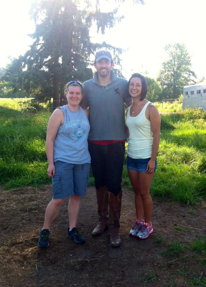
We got a hold of Brandon, one of our good friends who has a "ranch" outside of Vancouver in Battleground, and he gave us the address to come see him before we went home.  I haven't seen him in a couple years.  We missed his driveway but managed to fix our error.  We visited for a while and took a picture.


We made it home just before dark.  I dropped them off next door and came home to relax.  I fell asleep soon after.  5 a.m. does a number on you.

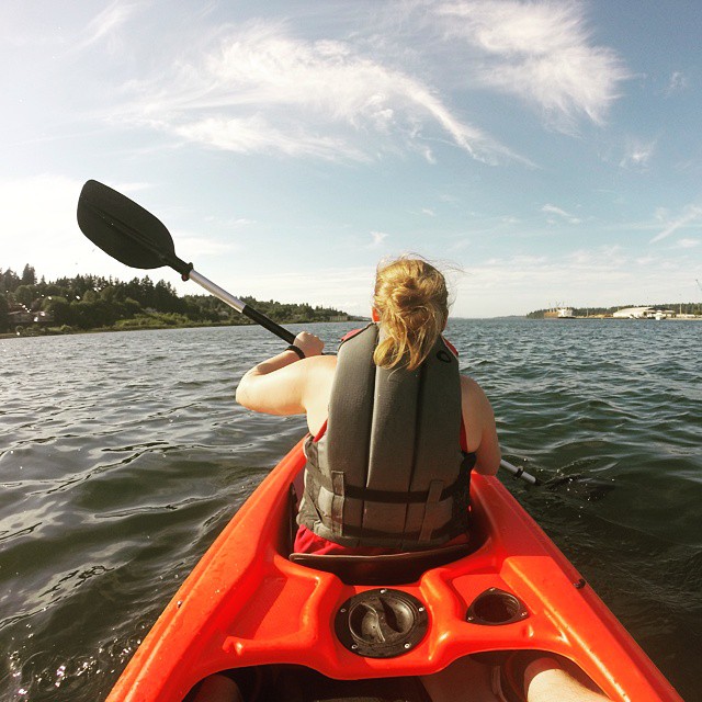
Next Adventure:  Kayaking with Ben

Friday, May 22

Travels with Val: Lewis County

I got up and made my self ready to go for our next adventure.  This time we were heading down towards Hwy 12 and Mossyrock.  I had chosen Lewis and Clark State Park and Ike Kinswa because there are more caches inside the parks I have not had time to go get yet.  I was really hoping the weather would hold up on us...it was very overcast and it could go either way.  I was hoping for some more sunny weather.

I threw the stuff into the Escape and went next door. Lacey wanted me there around 10.  I knocked on the door and she answered like she was busy doing something.  I wondered.  She had been on the phone with the phone company trying to figure out how to use another phone with her SIM card.  Apparently Nana smashed her phone with the truck lid last night by accident.  I have never seen a phone that destroyed ever.  She learned what she wanted to know and ended up using Nana's phone for the rest of the day.  She ordered a new one that will be here in the next few days.  We left as soon as she was done.  We got a later start than we intended but I was glad to be going somewhere with a friend I hadn't seen since last summer.

Our first stop was near the exit of Hwy 12.  I told her we would stop for two for some practice and some variety of what caches look like.  The two we stopped for were hidden by bearsandme, one of my good friends from Longview, she has a huge series following I-5.  This one was #61 in the collection (GC5D8N9).  I had Lacey look for it.  She had the knack for it as she walked right up to it.


The next one in the collection, #60 (GC59QDZ), was on the other side of Spiffy's (a famous restaurant known for their pies) we parked right next to it.  I told her before we got out of the car that I could see it from where I was sitting and to look for something out of place.  She found it immediately.


I set the GPS for the entrance to Lewis and Clark State Park.  Last time I was here I was with grandma and mom grabbing the only cache inside this park, for the state park geotour back in June 2013.  We tried to find the trail head, the area wasn't marked very well and the place was out of trail maps, so we wandered around for a while.  We eventually found our way to a trail, after some bushwhacking, and managed to find L&CSP-Temporary Support (GC46PGT) and found it inside the stump.  We found an ACFunk pathtag inside.  I know those cachers; they live in the TriCities.  We moved onto the next cache, L&CSP-Mossy Rest Stop (GC46PGY) just further down the trail.  We found that one quickly.


We walked further down and realized we missed the trail to the two other caches in the park.  We did figure out the coords to the multi but it was quite a walk away so I decided to save it for another time.  While walking the back 40, we heard some screeching and saw some very large movements in the trees.  Then I saw the owl in the tree.  We had a great view of him.  We didn't realize there was another one in the tree next to him until they both flew away.  "We got to see an owl!!"


We made the walk back towards the Escape mostly because we were hungry and wanted food.  The views of the forest were so amazing!


We got back and got our lunches out and found a good spot to sit and enjoy nature.  I went and used the restroom, which was being cleaned by one of the seasonal workers, I tried to stay out of her way.  I returned and my sandwich hit the spot.  We talked about friends, the stuff we've been doing, our travels and other things that happened to come up.


It was time to move onto Ike Kinswa, roughly 20 miles away.  We got onto Hwy 12 and a few miles into our drive, a bird violently hit the windshield.  It scared both of us.  I was glad to see it didn't run my glass.  We took the turn onto the 122 and drove the few miles until we reached the state park.  I knew we didn't have a lot of time to do all of them so I chose to do the ones at the boat launch.  We got out and walked around the area for a bit and then over to the boat launch.


We looked for IKSP-Boat Launch (GC46MTH) first.  I had the hardest time pinpointing this one.  It told me it was behind the sticker bushes.  I grabbed a stick and started beating the bushes.  No one wants to be scraped up looking for a geocache.  Lacey found this amusing.


I found out I was whacking the wrong place.  I found a little alcove and a great place to hide a cache.  There it was!  The last cacher couldn't find it and I was excited to prove it was indeed there.


The next one, IKSP-Old Highway (GC46MTP) was on the other side of the boat launch.  We followed the bank on a semi-used scenic trail and saw some great views of the lake.  I even found a buoy in the woods.  We found the cache and walked back.  I decided to take the buoy with me and to turn it into some sort of a cache later on.  We used the facilities before leaving the park.


Since we were in the area I found some of the other caches I haven't found since the last time I was here.  Ashes to Ashes, or is it a Birch? (GC1RW8E) was in one of the cemeteries.  It was almost Memorial Day so I thought someone would be up honoring their loved ones.  Luckily this one was right next to the Escape.


I knew Mossyrock was known for their tulips and flowers.  I thought I would take Lacey to the flower fields just to see if they were still around.  There were very few flowers left but they were still pretty.  The Peony's were in bloom.


I had Swofford Pond last on the list.  I didn't know if we would have enough time to come here or not.  I plugged the coords into Nuvi and she took us through town and out to the road to the pond.  We stopped a few times to grab Easy Peasy (GC59BJV), Road Less Traveled (GC59BJN), The End (GC59BK8) and Swofford Pond Overlook (GCP3M5).

We headed down to the pond.


We tried looking for two caches on the banks of the pond but came up short.  I will have to come back when I know they are there.  We found some cool fishing spots as well as talked to a couple of old men who knew people I knew.  Small world.


We made our way back home.  We stopped in Centralia to get some gas that Lacey offered to pay for which was very kind of her.  I appreciated it very much.  We got home around 8ish and I dropped her off next door.  We briefly talked about our luau game night that was scheduled for the next day.

Next Adventure:  Travels with Val:  Columbia River Gorge

Thursday, May 21

Travels with Val: Thurston County

My friend Lacey, who I have known for over 20+ years, came up to Washington to visit for three weeks.  She was transitioning from one job in North Dakota to another in Florida.  She had some day that were unplanned so she asked if we could take a couple of trips around the area.  I said sure!  Let's go!

I asked her where she wanted to go and she said in the Olympia area.  First we stopped by HopJack's for some lunch.  I got a burger and she got the street tacos.  While we ate, we got caught up on all the changes that were happening in our lives and the future endeavors.  I told her after we were done eating I would take her to a cache or two.  She was up for the challenge.

I took her to Let's Start Out with an Easy One...Sort of (GC5R6NN) just down the Yelm Highway towards Tumwater.  I put the coords into the GPS and off we went.  We found a parking spot and started looking.  My GPS was taking me everywhere but to the cache.  Maybe some new batteries?  We eventually got to the right tree and I asked Lacey where she thought it was.  She pointed to the stick and I thought to myself...this seems too easy.  It was.  It was a red herring cache.  Dang it!  We were fooled!  We looked around some more and I saw a bison tube hanging in the tree.  Here's the real cache.


Then she mentioned that she wanted to see the Deschutes River.  I told her there was a park up ahead and it's southern boundary was the river.  She got excited.  First we stopped by a new park that used to be someones property that we both knew.  It used to be a fastpitch field that we spent a lot of time at practicing for the Dynamite.  It was weird to see what it had become...a boring park.  We stayed for a few minutes and then headed out to Pioneer Park to wander around for a while.

We parked somewhat in the shade and made our short walk to the bank of the Deschutes River.  There were some people enjoying the cool water with their dog.  It was still too cold to go swimming even though it was a really nice warm day.


We walked around the various trails and I remembered that there was a cache here that I didn't have yet so we meandered over to it.  We used the restrooms and saw some cons who were doing work somewhere else, they had to be escorted to the bathroom and then back to the vans.  We waited until they were gone.


We followed the GPS over behind the baseball fields and to the swampy area.  We looked for Pioneer Park:  47th Parallel (GC4CQ05) and could not find it.  It was a medium-sized cache container and there was no trace of it.  We walked back to the Escape and made our way towards Deschutes Falls in downtown Tumwater.  She said she hasn't been there in a very long time.


We parked in the lot near some shade and started our walk near the totem pole.  We took many pictures along the loop.


We walked down to the platform to get a better view of the falls and got sprayed.


We explored more of the area and found a hidden alcove on the other side of the falls.  It was serene.


We completed the loop, took a bunch of photos and walked back to the Escape, it was time to move onto our next spot, downtown Olympia.


We took the back way down Deschutes Parkway and tried finding a place to park near the boardwalk and the park along Capitol Lake.  We finally found one on the south side of the lake and we had to back in, luckily we were there late enough to where we didn't have to feed the meter.  We got out and we walked along the shoreline.


I took her across the street to the fountains.  A lot of little kids were enjoying the vertical spray on this very warm day.  We talked about various things including her trip to Hawaii and her renewed acquaintance, Wayne.  We walked the boardwalk and then decided it was time to head home.


I dropped her off next door and asked her before she left if she had plans for tomorrow.  She said no and mentioned that we should go do something tomorrow.  I had some sort of a plan in mind it just depended if she wanted to go wander around state park trails.  I texted her a few hours later and asked her if she was down with heading to Lewis County and she said yes!  It's on!

Next Adventure:  Travels with Val:  Lewis County