Thursday, June 27

Tacky Thursday: Yelm Prairie Days


Mom and I at the Yelm Prairie Days parade.  I dressed up as Plak, a bad guy trying to get kids to eat candy and not brush their teeth, and she took pictures and handed out goodies to the crowd.

Monday, June 24

Washington State GeoTours, Coast Edition

After our misfortune yesterday...

We had planned to to the coast tour for Sunday but instead we did it today because when we got to Shaefer Park yesterday and was ready to walk up the hill to the cache, Bob and Bev could not find their passport.  They had left it on the table at home.  I walked up with a couple cachers since we were there and Bob and Bev waited for me in the car.  I returned after a half hour later and then went home because we couldn't go any further without the passport.

Today Bob and Bev redeemed themselves.  We drove back to Schaefer Park and they got their stamp.  Now we could move on with the rest of the caches on the list.  It was going to be a long day.


From there, we went to Lake Sylvia State Park.  Last time I was here, it was for my brother's cross country meet my senior year of high school.  We parked the car as close as we could and followed the trail along the lake to a dock and a bridge that took us over the water to the other side of the lake.   We passed a fisherman who wasn't having any luck.  We saw some cool trees on the way.  We got to the cache site and Bob found the cache quickly, we stamped our passports, logged our names and walked back to the car.


We headed west towards Aberdeen and got rained on hard just before the Welcome to Aberdeen sign on the right.  It kinda made us nervous.  I did not want to get soaked while we were at the beach or at all for that matter.  We decided to take a short cut so we wouldn't have to do a lot of back tracking.  So we took Ocean Beach Road at Copalis Crossing.  That took us through two small towns called Carlisle and Aloha.  Of course the cell phones didn't work in this area.  We followed the Nuvi to Pacific Beach State Park, another park I don't think I've been to.

When we arrived and grabbed the cache, a car pulled up beside us. It was the Logan Six on a summer jaunt to the beach to grab some of the state park caches. We all stamped our passports, signed the log and chatted for a few minutes. I put the cache back into it's hidey spot and off we went to the next one.


The Logan Six unintentionally ended up following us to the next one down in Ocean Shores.  We arrived at Ocean City State Park first with them pulling up just behind us.  We thought we would combine forces and find the cache together.  We got close to the cache and the GPS's ended up leading us to the wrong set of bushes.  We had to walk around the small creek to get to the other side where this small group of trees were.  We bent down and found the ammo can right away.  We dropped some of our trackables after trading codes with our new caching friends.  We put it back better than we found it and made our way back to the car.  We still had a long ways to go.

We drove back around the harbor and back into Aberdeen to get onto the 105 towards Westport. It's been a while since I've been here.  I don't think I've been to Westhaven State Park. We followed our GPS to the parking lot.  They were doing construction.  We speculated maybe a new bathroom?  We started walking towards the cache.  We saw where we needed to walk and as we got up and onto the ledge it was crazy windy! We headed out towards the jetty and saw many people crawling around, fishing and sight seeing. We found the cache quickly and then enjoyed some picture taking.


We walked back towards the car and found out there was another cache nearby so we went and looked for a few minutes.  We didn't find it but we needed to go if we were going to get all eight of the state parks done that we had planned to do.  Off we went to Twin Harbors State Park just a few miles south of us.

We were quick to find out there are two parts to this state park and we meandered through the roads to find a parking spot fairly close to the cache. We got out and found the small trail through the ghostly trees. Bob found the cache right away and we hurried to stamp our passports, sign our names on the log because we were being eaten alive! The mosquitoes were terrible! A cacher had warned us but had forgotten which park it was until we got here. We returned to the car and grabbed the virtual, Shifting Sands, on the way out.


Just down the road again, was Grayland Beach State Park.  I may have been to this state park but it's been a very long time. We made our way through the camping area and found a place to park. We walked out to the beach along the small trail and walked along the beach to GZ. We found out we took the wrong trail but it got us there anyway.  It was very windy but it felt good because it was a bit muggy warm outside. Bev made the quick find once we got to the cache site.  We got our passports stamped and our names logged and then walked back to the car.  We checked our map to make sure what the next one was.

En route to Ilwaco/Cape Disappointment, we stopped in Tokeland at the haunted hotel.  The Tokeland Hotel and Restaurant has always been on my list of places to see since I found out it was haunted some odd years ago.   It was listed on the National Register of Historic Places in 1978.

More about the Tokeland Hotel:  http://www.tokelandhotel.com/


Yes there was a cache near the hotel.  Bob and Bev had been here years ago and tried to find it.  We looked for it today and it turned into a confusing multi.  We found all of the containers and wrote our names down in all of them just so we covered all the bases.  We went back to the car and told Bob what we had to do.  I talked Bev into pictures in front of the hotel.


We drove back towards the highway and got gas at the Georgetown Gas Station.  We ate our lunch as we drove.  I'm glad I brought food with me.  We followed 105 along the water's edge.  We had to stop several times at the bridges because they were under construction.  The longest we had to wait was about 15 minutes.  We got to Raymond and hit Hwy 101 south towards Ilwaco/Long Beach.  We went through South Bend and contemplated stopping and getting some along the trail between the two towns but we figured it would waste valuable state park cache time.

While driving along 101, I recognized several places we stopped along the way when we were here for the Long Beach Cache Machine, back in January 2012.  When we finally got into town, we followed where Nuvi told us to go and because the roads are all crazy she took us to the wrong place.  We figured it out via the parking coords, where we were suppose to go and found out we had to climb a hill.  Bev was not too excited about a hill this late in the day.  She got her game face on and went up the hill with Bob and I.  It actually wasn't that bad of a hill.


I walked up beside Bev and Bob booked it up the hill. He ended up finding the cache before we even got there. We logged our names, stamped our passports and took a few pics. We admired the views and the old cement structures before heading back down the hill.  I joked around with Bev about the hike we did back in November.  She said in her log that, it was not as bad as Pinnacle Peak in Enumclaw. We headed back down the hill and to the car.


One more state park to go.  I remember driving past this park when we went across the Astoria-Megler Bridge (4.06 mi) to get into Oregon for some caching with Brad and his crew over a year and a half ago.  I never really noticed that it was a state park until this challenge.  We drove past it the first time and had to turn around and come back.  There wasn't that many people in the park and Bob parked as close to the cache as he could.  We got out and took the short walk to a stump hidden from the public's view.  We signed the logbook, stamped our passports and put it back.  We looked at the buildings and the battery and used the restroom before starting out long drive back home.


We couldn't decide if we wanted to go home the way we came or go home through Longview.  I immediately checked the distance and hours it would take to get home.  We decided to go back up to Raymond and hit Hwy 6 home through PeEll and Adna.  Along the way we found several of newly placed Bearsandme caches, we had all pretty much wiped out the area.  We spent an hour or so picking up ones along the road.  We got about 8 of them.  One required us to go off roading along a really rocky road.  That made Bev upset.  She didn't want her car to get broken out in the middle of nowhere plus her car should not be doing stuff like that in the first place.

When we got into Raymond, we stopped at McBob's for some dinner.  I had the two cheeseburger meal and it was delicious.  We ended up getting home late.  We got about 18 caches all together.

Next Adventure:  Rainbow Falls, Willapa Hills Trail Head, Ike Kinswa and a Pool

Saturday, June 22

Olympia Cache Machine II

While I was doing the ET Highway with Brenda and Ray, I asked if they were going to the upcoming cache machine in Olympia.  They said most likely and they usually go with JHolly, a guy I thought put together the caching routes.  Apparently he doesn't.  But how did he come up with our private cache machine route?  Hmmm.

I thought I should go because I have some caches in the cache machine and I should do my own hometown one anyway.  I had a few random ones I still had to get.

Ray got a hold of me a few days before with the private route and what time and where we were going to meet up.  I got my stuff ready the night before.  I was exhausted and I knew Saturday would be a very long day.

My alarm went off at 6:30 and I really did not want to get up.  I threw my clothes on, it was suppose to be a nice day, so I wore shorts.  I grabbed my caching backpack, my gps, camera, phone and a few snacks for along the way.

I was suppose to meet them at cache #1 at 7:30 a.m., I left my house just before 7.  It takes about 45 minutes to get to west side Olympia.  I got there at 7:27.  I love that no one was on the roads that early...except for the geocachers of course.  Brenda and Ray were waiting for me in the parking lot where the Old Navy used to be.  They found the cache in the small rock wall before I got there.  A few minutes later Jim arrived in his brand new 2014 Subaru Forester.  I gathered my stuff for the day and threw it in the trunk.  I got in the back seat with Brenda, it even had the new car smell.  Between Ray and him, they had all of the gps's ready to go.  Off we went!


The morning went by pretty fast.  We started near Evergreen and I found out I had a few caches over that way I haven't found yet.  I ended up talking to Lisa, a co-worker of mine, through out some of the caches along Puget Sound north of downtown Oly about a job I recently applied for.  She said to keep an open mind and I may be in a different group later on in the year.  My mood from the day before got a little better.

I have been to most of them so I tried not to be annoying by showing them where the cache was.  I tried to let them find it before I assisted in any way.  Some of them they wanted to know where it was and some of them I simply could not remember because it was so long ago...some of them more than two years ago.

We went into downtown Oly and spent some time near the Farmer's Market.  I knew we would not be doing a lot of the ones near the market because everyone would see us and about a month ago, OhJoy disabled most of her caches so people would not be able to find them, which is understandable because most of hers are in sensitive areas.  They would suffer with that amount of traffic in one day by cachers walking through.  However, she prematurely disabled them and none of the locals could go out caching prior to the cache machine.  One or two weeks before could have sufficed.

We got to caches 20-25 and they definitely brought back memories.  They brought us to the area between downtown Oly and the west side of Lacey near the Watershed Park.  I could not remember where the Offering for the Creature was.  That one took us a while to find.  Woodworkers was one of my favorites because of the little carvings of workers nearby.  I knew the cache was on one of the trees but could not remember which one.  Brenda had fun.


The nano on the fire hydrant was easy, that one took me two trips a few years back to find.  Payback 9 was also one of my favorites.  It was one of the very few OhJoy caches on the cache machine.  Someday I would really like to go rollerblading on top of the structure.  This is where we met our first set of cachers, they were from Seattle.  We had never heard of their names before today.  We discovered their TB on the back of the car.

We got a few more and then it was lunch time.  We parked the car in the parking lot of the Olympia Food Co-op and ate lunch out of the back of Jim's new car.  Jim ate a sandwich and Brenda and Ray had a really tasty salad and they shared some of it with me because I had only brought snacks.  I ran out of time last night to make some proper food.  The salad was really good.


Some of them I could remember and I could give them a general hint to get them to the spot.  There was one I visited a few years ago in the dark.  I was really happy to visit it in the daytime as well.  I thought it was a very clever yet cute cache.


The cache was inside the ACME ball.  Sadly, the cap to the cache was missing and the logbook was soaked.  Ray and I got out one of our ET Highway logs and replaced it.  It was too bad we didn't have an extra cap to keep that logbook from getting wet.

We made our way over towards St. Martin's area and grabbed 11 easy ones and I actually remembered where they were.  Before Ray, Brenda and Jim got out of the car they asked for some hints.  I couldn't believe how much the caches have moved since I found them.  Some of them were actually hard to find again.


We took a short walk on the CWT to go grab My Favorite Things-CWT.  I remember coming here twice, once on my bike and once walking.  I remember the coords being terrible and we spent a huge amount of time looking for it.  The first time it was missing and then replaced.  The second time we looked on the other side of the trail and found it.  Today, we walked right up to it and walked back quickly to the car to move on to the others along the route.


The next section took us near LBA Park and Olympia High School.  We were scooting right along until we got to one I've had problems with.  I came here over a year ago with my mom to grab this one since we were in the area and I needed a cache for the day, this is when I was doing my 365 days in a row streak.  It was on the opposite corner of the soccer fields for OHS.  Jim parked the car and opted to sit there and wait until we found it.  We went in there and there were tons of ants and very large ant piles.  I decided to stab a stick into one.


While we looked for this one, two other cachers joined in the searching efforts.  I didn't get their names but they were very happy when we finally found the cache, which was about 40 feet off.  I was relieved to have finally gotten this one off the list.  I even remember searching in the area I found it in.  Hmmm...

The next few took us to Capitol Blvd and to many I had fun finding the first time.  It was hilarious watching Ray and Jim look for the one near the flower lady, Brenda and I stayed in the car.  Ray said he saw the cache when we were pulling into the driveway.  We grabbed the Tiki Bridge really quickly and moved onto the Tumwater area.  Jim thought he knew where he was going and we ended up making a few U-turns.  Some of them were really difficult to remember where they were, but then again many of these we were going to I found in the dark.


We made it back into Tumwater at the 2nd Street Micro is where we met up with Lookout Lisa, kidvegas19, Bikely and TheDiver.  We exchanged some quick conversation and moved onto 47th Parallel.  It was a new cache I watched publish a few weeks ago.  Apparently there were two of them and I got them mixed up.  We found a place to park nearby, Ray, Brenda and I went and grabbed it.

At cache #63, Baa Baa Blacksheep, I remember going to in the daytime, but there was construction on Trosper Road...ironically I found it exactly 2 years ago today.  I told Ray before he got out of the car that the container was really weird to open and may take him a while.  We sat in the car and upon his return he showed us the five dollar bill he found in the pull out just behind the car.


Do not open 'till Christmas was the one that moved about a yard from where I found it last.  I actually thought it went MIA until Brenda saw it through a hole in the fence.  It was now on the other side of the fence instead of in the molested falling apart stump nearby.  I was in awe.  I did warn her that it did make a sound when you opened it.  She was still surprised, as she almost dropped it on the ground.  Haha.

We went to Zen's Pit, another one I went to around dusk-ish last time I was there, I really don't remember how we got into the pit but now it's more over grown.  We found a trail and made our way in and found the cache quickly and unscathed from the sticker bushes that lined the trail.  We drove up on the hill to the next one over looking the State Capitol building.  I remember there being an actual letterbox nearby.  Brenda and Ray wanted to see it so I pulled it out of its hidey hole.  We found the actual cache and logged it.  I never got to walk up to the top so we went up to see the view.  I should have brought my camera with me.  Ray got a picture.


Then we went on top of the hill near the courthouse and found a few other quick ones.  One did require all of us to get out of the car and find.  We let Jim find this one.


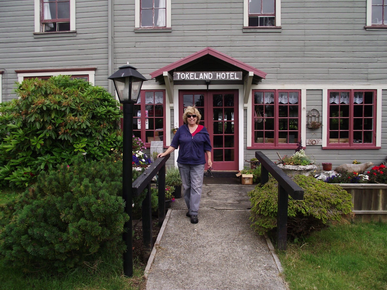
We were starting to run out of time and we wanted to be at the event dinner before everyone got there so we took a quick detour.  Sadly, the ones we did skip were the ones along the trail in the Tumwater Falls park.  We all agreed to go grab my caches before we went to the dinner.  We went to Tumwater Falls Historical Park, that gave you a great view of the old brewery.  This was a separate part to the falls park above.  I let everyone find it before I gave them a hint.  Brenda made the find.  I picked this spot for a reason, isn't it a great view?


We went to the last one, Pretty Odd Oly, my only rock wall cache.  About a month ago, Bev and I drove around doing some maintenance on my caches, put in new logbooks, updating coords, etc.  I knew there would be a bunch of people and not a lot of log space for names.  That's just what you do when your caches are involved in a cache machine.  I was pretty proud of that.

They found it quickly and Jim drove us back where our cars were parked.  They were ovens inside.  I had Brenda and Ray follow me downtown to Ramblin Jack's.  I've never been there and I live nearby.  I knew there wouldn't be any close parking so I went and found a parking meter across the street.  Parking was free on the weekends so I didn't have to worry about coming up with some change.  I grabbed my stuff and my name tag and walked on over.

I saw Bob and Bev made it.  I talked to them for a little while.  Brenda and Ray were with us, Dan talked to us, Sean made an appearance, I saw Dwight and Gabe, talked to Ben and Jayme, Abby came over for a while, Lisa visited for a while and asked me where the best place for dinner was and I told her the Fish Tale, down the road.  Brenda and Ray shared their food with me because twenty dollars was pretty expensive and I had a bbq/bon fire to go to later on that evening.  I had my trackables out to discover and some people did stop by to look at them.  I stayed until about 8:30-8:45.  Then I had Brenda and Ray follow me home so they could find Make Me a Sammich and take the bag of trackables home with them.  They enjoyed the creativity of the cache, even though it was hit by a tree a couple weeks ago.  I need to do some maintenance on it.  They drove home afterwards.  I went to my bon fire/bbq over at Celeste's house.

Thanks to everyone who found my caches on the cache machine, Jim for letting me ride with him and Brenda and Ray for inviting me to go along.  You are very nice people and I am happy I met you.  :)

"Well, we had another great time with Jim and our special guest Val during the Olympia Cache Machine. This was our first time to Olympia and it was nice to see the sites and surroundings while we were looking for caches. The weather turned out perfect for caching with low clouds and fog in the morning and burning off to clear blue skies the rest of the day. We ended up finding 70 caches for the day which wasn’t too bad. At the dinner we had a good time talking with cachers that we hadn’t seen in a while along with one’s that we cached with recently. We are looking forward to next cache machine which will be in Bend Oregon on September 21, 2013."  

-Brenda and Ray (Geek&Gopher) written on the WSGA SW Chapter Facebook page.

Photos were taken by Ray with a Garmin Oregon 600T and a HTC Android smartphone, those were instagrammed by Val.

Next Adventure:  Washington State GeoTours:  Coast Edition

Friday, June 21

Shop Hop and Tolmie State Park

It was another shop hop day with Grandma.  I got up early and went to work.  It was pretty short because the assistants had a training day on the new crown machine.  I got done before noon.  I called Grandma to see if she would bring me something from the store.  She got me some chicken strips and a chocolate maple bar since the maple bars were gone already.

She picked me up and to Shelton we went!  It was a short day so we planned on getting the stores nearby and Tolmie State Park.  When we got to the quilting store in Shelton, the quilt store had moved from the old part of town to the new part of town near the McDonald's, Burger King and Goodwill was.  The ladies inside were pretty excited about their new location.  We were basically the only people in there so we got a demo about the new-ish triangle cutter they called the flying geese.  I learned something new about quilting.

We went back into Thurston county and hit up the Tumwater quilt store.  That was a quick in and out.  One more pile of quilting block materials to add to my bag even though I was posing as my mom for the day.  The next store took us to Bayside, a place I have been to many times throughout the years.  At this place, they had a drawing for a prize every half hour or so.  We got our tickets but didn't win.  Grandma ended up buying something.

We continued on our loop.  We made our way to Tolmie State Park, the next state park on our list.

We drove to the parking lot down the hill and made our way to the trail head. My first time to this park was about two years ago when I visited to get the first set of caches in this park. Not sure if they were in compliance or not. There were a lot of people enjoying the park today but we didn't see anyone on the nearby trail that we took to the cache. The trail was dry, thank goodness, and we didn't have any trouble finding the cache. It was a relief that it was a short walk from the parking lot. After, I took Grandma to the nearby beach.  The tide was out so there really wasn't much to look at.  We went back to the van and drove to the last quilting store in Yelm.


We made our way to Gee Gee's, where once again I posed as mom.  They knew her here so maybe they won't notice?  Haha.  Mom wanted us to wait for her but she took too long and we ended up meeting her at Walmart instead.  Grandma dropped me off in the parking lot and I met up with mom shortly after.  When we got back home my evening ended up being one of the worst days I've had in a long time.  Thankfully it all worked out in the long run.

Next Adventure:  Olympia Cache Machine II with Brenda, Ray and JHolly

Thursday, June 20

Shop Hop, Dash Point and Saltwater State Park GeoTour

We had a bunch more quilting stores to hit up and two state parks to grab along the way.  This year we decided to do the route backwards starting in town and ending out in Eatonville.  Last year we started in Eatonville and ended it town...with traffic. 

Our first stop was at the Spanaway quilt store off of Pacific Ave.  As soon as I parked the van, Mr. Gowan called me about some kittens he recently acquired.  He talked to me for about 15 minutes about how he could get rid of them and needed my help.  I told him to put them on craigslist and I will make an announcement on Facebook.  I don't know if he ever did that or not.  We got our passport stamped and was handed a block packet.  We went back to the van and went to the next one.

The next one took us down the road to a quilt store that moved since this years shop hop.  It was hard to find a parking spot.  We went in quickly, got our passport stamped and our package of block materials.  Each store had some unique quilts on the walls.  We escaped before the parking lot got extra busy.

The final one in Tacoma was very memorable.  We found a place to park, thank goodness it was near the quilt store, we went in, had our passport signed and got our block bundle.  We were just about to leave when a whole bus of old ladies came in and every single one of them had a walker.  I think it took all 12 of them about 10 minutes to get through the door and we had to wait.  We hustled to the van and followed our route north, which brought us to our first state park, Dash Point.

I haven't been to Dash Point in quite sometime. Last time I was here it was with a friend from Federal Way and we wanted to go on a mini adventure. So we hung out on the beach. Today, we had some time between quilt stores to get out and stretch out legs. We drove into the park as far as we could, I parked the van and I ran down, grabbed this one quickly while grandma guarded the van. The walk down was fast but the walk back up was a bit more slower, those darn hills!


The next closest spot on our GPS was Saltwater State Park, just up the road from where we were.

This was my first time to this state park and I saw the sign for it often driving back and forth on I-5.  We pulled in and had to sit behind a California licensed plate car while a woman read all of the stuff on the side of the welcome building. She realized we wanted to go in so she moved her car. We drove down the hill and to the cache site. We found it quickly since it was an arm's length away from the van, stamped passport and logged our names. The great thing about this series is that there is always a bathroom nearby. Used the facilities and enjoyed the beach a couple yards down from where we parked.


The weather never got nice and rained later on in the afternoon and we managed not to get wet, which is a plus! We had a great time grabbing the two state park caches and enjoyed the beaches.

We found out the road we were on would take us right to the Des Moines quilt store.  I remember driving to this one last year because next door is a hot dog restaurant with a Seahawks pig in the front of it.  I really thought about stopping and taking a picture with it but decided to stay on schedule. 

We went to Kent, Covington, Black Diamond, Buckley, Orting and Puyallup all in a few hours.  We stopped in Black Diamond for some lunch at the Diary Queen for the five dollar lunch meal.  It was delish.

We finished up at the Country Mouse in Eatonville because we had some time to spare.  There, we got the quilt poster because it was cheaper than the rest of the stores.  We got home about dinner time.

Next Adventure:  The Rest of the Shop Hop and Tolmie State Park.

Wednesday, June 19

Western Washington Shop Hop and Washington State Parks GeoTour SW

Mom had the day off so her and Grandma could go and do the Western Washington Shop Hop.  Basically it's a five day long event that involves quilt stores.  You have a passport, that the shops stamp with their unique stamp and they hand you a block packet.  Inside the block packet is what you need to finish that quilt store's block.  You get all of the blocks and ultimately you can make a quilt out of them.  Some shops require you to buy their finishing kit, which costs anywhere from a dollar to four dollars, and inside is extra fabric and some knick knacks.

Somehow mom talked me into going with them.  Of course they made me drive.

Today we were going down south towards Vancouver.

The first quilt store we went to was Centralia, near the famous Yard Bird, who was getting a face lift from the damage the floods did to it.  A few miles south we hit up the Chehalis quilt store.  That one we went in and out of quickly.  The next one was in Castle Rock, I've never been to that one before.  The ladies were nice.


We got down to Longview and went to our first one, there, we saw a little person packaging the blocks to hand out to people.  I was so excited to see a male little person at a quilt store.  I have a co-worker who just loves seeing little people, so we sent her a picture of him.  When we got in the car, my mom immediately called her and she shrieked with joy.  We went to the other quilt store in town but didn't have as much fun as the previous one.

We started making out way down to Vancouver.  There were three shops we had to hit up. Inside one, which was hard to get to because of the construction, I found a pattern of a cartoonish Cougar with a football uniform on.  We are so going to make this so I bought it.  It was the first quilt-like thing I've ever bought.

We were hungry and everyone felt like hamburgers.  We put it in the Nuvi and it found the nearest Red Robin.  It was near the mall, a place I have geocached before.  So there wasn't anything close by to grab.  We all got our food and Grandma looks out the window behind us and goes, wow, look at the rain!  It was pouring buckets.  Very large buckets.  I sure hope it died down so I could get the caches I had in mind this afternoon.  We finished our food and got back in the car, the rain had gone away...for now.

We put the coords in the Nuvi and meandered around the back roads, through Hockinson, until we got to the state park.

I have never been to Battleground State Park and my aunt lives down here, haha. We parked in the lot and walked down the hill to the lake. I expected it to be bigger. We took the trail to our left and walked down the bumpy trail. We needed to walk off our lunch anyway. We got to the cache zone and I knew where it was before we even got to it because I would hide it there as well. A small family was fishing nearby so I had to explain what we were doing. Luckily, the woman has a co-worker who goes out caching too. I showed them the container and the passport. They thought it was a great way to get out and explore, especially the state parks. We stamped our passports, signed the logbook, put it back and walked to the earthcache on the other side.


The lake was smaller than I thought it was.  We got to the other side of the lake and started working on the earthcache.  There was a family with two small kids at the cache site.  We told her we would only be here for a few minutes.  We answered the questions, took our picture evidence and walked back to the car.


Plugged the coords into Nuvi for the next state park. It took us up I-5 to Seaquest, across the street from one of the Mt. St. Helens visitor's centers.

I've never been to Seaquest State Park but I have driven past it over a dozen times to Mt. St. Helens.  We drove in and it started sprinkling. I had to hurry so I didn't get soaked. We didn't know where the trail heads were or where to even start. We drove to the parking coords and went from there. I saw where to enter from and knew I had a walk ahead of me when I saw how far away it was. Mom and grandma stayed in the car because they are weenies. Off I went. I was so glad to see the cache after the long walk. Stamped my passports, logged our names and back I went. I didn't know if I should continue or go back the way I came. Then I found a short cut and had them meet me where it came out of. Then it started raining harder. Ew. I got to the car and they said they had a nice visit with the ranger who didn't see our Discovery Pass, that we won at the state parks kick off celebration, in the window, lol.  Glad to have gotten that one out of the way.


The last one of the day was at Lewis & Clark State Park.  I never knew this state park was here until this series, this was right off the freeway on the Jackson Highway. We parked near where we thought the trail head was. We picked the wrong trail but managed to get where we needed to be. It was dry, thank goodness and everyone was in awe of the enormous trees. We found the path that led to the cache. We found the cache with no problem, stamped our passports, logged our names and put it back where we found it. We made our way back to the car, this time down the right trail, haha.


We found out we didn't have enough time to make it to our fourth state park.  It will have to be another day and everyone was tired from the long day.

Next adventure:  More Shop Hop, Dash Point State Park and Saltwater State Park

Friday, June 14

Olympic Penninsula State Parks GeoTour

Bev talked to Bob about doing some of these state park caches and we decided we were going to do it on Friday.  I didn't work Friday so it was kinda weird being gone all day.  I did make up the hours by being there Tuesday all day and Thursday for part of the day.

I originally thought we were going to do southwest Washington but we went up 101 along the peninsula instead.  Which was totally fine with me.  I was excited to explore a new area of Washington.  I got all of my stuff ready the night before.  It was suppose to be a nice day but you never know along the water.  Earlier I got the map printed so we can visually see as we went, which was very helpful on our mini trip.

My alarm went off at 6:30 and I got ready.  I got to sleep in an hour more than I usually do on Fridays so that was nice.  I gathered all of my stuff and headed out the door.  They were waiting for me in the drive way.  I threw my stuff in and jumped into the back seat.  We drove towards Lacey.  I guess we were going to Denny's before we headed out.

They both got the $4 Grand Slam and they asked for only one pancake and they did it wrong so I got the extra pancakes, part of an egg and a piece of bacon.  We saw Pa from Da2Svedes sitting in another section of the restaurant with some buddies.  We used the bathroom, paid for our food and talked to Pa for a few minutes.  Then we headed to our first state park, Jarrell Cove, near Shelton off of Hwy 3 towards Belfair and Bremerton.  It was one of the three multi caches we would do today.

I have never been to Jarrell Cove State Park.  We found a place to park and went to the first waypoint.  We grabbed the necessary information from the first waypoint and we were pretty sure we did it right. A camper nearby thought we were doing a survey for the government and that we were getting grant money to do something that easy. We told him it was a game used with a GPS. We don't think he understood.  We found the trail and walked towards the cache.  I saw it before everyone else.  I pointed Bob to the right direction while I took video and some pictures.


Before we got in the car and moved on to the next state park, Bev talked to the hosts for a few minutes.  The next one was decided on a whim.  I told Bob that we could make a circle and end back on Hwy 101 and we would get two park caches along the way.  He agreed even though we had no idea how long these next two caches would take.

We got into Belfair and grabbed the state park multi just outside of town.  We didn't know what we were in for.  After reading the other logs we kinda got worried. We found wp1 on the ground and put it back where it was suppose to go. Wp2 was out in the open so we put a piece of bark over the top of it to conceal it better and wp3 was hidden well inside a metal water well. The final coords put us in a campsite near the bridge. We looked for a while and didn't find a container so we went and talked to the Ranger and one of the workers. The worker told us where he thought it was and bam there it was. It blended in really well but we were 149 feet off with the coords. The Ranger we talked to knew that there was a geocache in the park but this was the first time he saw the location. We made a note of our misfortune in our logs.


We drove back through Belfair and onto Twanoh State Park, off of the 106.  I have never been to this state park either.  We found a place to park and realized the park was packed with people. There were some kids here for a field trip so there were frisbee's and footballs flying around. We had no trouble with the first few waypoints. We walked over towards the water and found out there was a kayaking event and lots of people in the water learning what to do if you tip over. The last waypoint before the final kinda had us scratching our heads. We looked for about ten minutes then I had an idea. What a great idea it was. We grabbed what we needed and off to the final we went. We tried to be really sneaky because there were lots of muggles were driving by looking for a place to park.  We jumped in the car and headed to the next state park, Potlatch.


When we got to Potlatch it was very primitive compared to the others.  We drove in and followed the road to the back of the campsite area.  There was an open parking spot so we grabbed it.  We got out and found out the cache was .20 away from the car.  That doesn't sound too bad.  We started walking and walking and walking. The hills almost killed Bev. How much further? 500 feet....

We made it to a fork in the trail and decided to go down the stairs. Bob walked past the cache and I saw something unusual and there it was. Our fourth state park cache of the day. We took a few pictures and wandered back towards the car. That was one of the hardest walks so far.


Just up the road was a small state park called Triton Cove.  I've driven past this place several times and didn't realize it was a state park. It was nice to finally grab a cache that was very quick and easy.  It was basically a pull up and grab without leaving your car. Especially after all the crazy multis and hilly walks. We put it back as we found it.


A little bit more north up Highway 101 was Dosewallips State Park.  We took the wrong entrance after we found out the cache was not even close to where we were.  We found the correct road and found the trail that lead to the beach area.  We took the short walk down the trail and passed two men who had been clamming. They had a bunch in their buckets. We got out to the clearing and noticed the platform. There were a couple of people up there with painting supplies. I don't even think they saw us.  I found where the cache was, took it down from the bottom of the platform and brought it over to Bob and Bev, who were sitting on the bench.  We signed it, stamped our passports and then I got back underneath and put it back better than I found it.  We walked back to the car.


The next state park was quite a few miles away so we picked up a few along the way that we all haven't gotten yet.  We ended up east of Quilcene at a cache that wasn't there, so the detour we took was a waste of time.  We got back onto 101 and found our junction, near Discovery Bay on SR 20.  We went towards Anderson Lake State Park.  It was going to be another walk according to the description.  When we got there, the lake was pretty gross.  There were signs up telling people not to go in the lake because it was infested with a invasive species so it was closed until further notice.  We found a place to park and Bob and I walked down the trail.  It got muddier and muddier as we got closer to the cache.  There were tons of black slugs and orange caterpillars.  A horse had been through here recently, we could see the horseshoes in the mud.  We had no problem finding the cache.  We signed the log and stamped our passport.  And now the trek back to the car, where Bev was waiting for us.


We grabbed a few more along SR 20 until we got to the Jefferson County Airport, a webcam I've had on my list for quite sometime.  The night before I made sure we could do it from my phone.  We parked the car and walked to the given coords.  We didn't know how long it would take to refresh and my phone was dying so it went dim.  I had a heck of a time trying to see the photo on the screen.  I had to put it down my shirt so I could see it.  I knew when it refreshed it would have me looking down my shirt.  There were two guys washing an airplane nearby and probably have seen other cachers doing what we were doing.  Bob got impatient and I told him to wait a few more minutes.  I refreshed it again, still nothing.  About three minutes later I refreshed it again and there we were!  I save about five pictures onto my phone just in case.  We went back to the car.


We drove up the road into Fort Townsend, another park none of us have been to.  We parked the car, almost fell on my face after tripping over a few roots on our way to to the trail head and walked down the hill. There are lots of hills in these state parks. I'm glad we didn't have to carry Bev up the hill. We found the cache quickly, signed it, stamped our passports, put it back and walked back up the hill, while enjoying the view, across the bay was Port Townsend, and headed to the car.


We got gas at the first gas station we saw.  Bev was worried about how low the tank was.  A lady inside suggested a pizza place downtown for dinner.

The next state park we went to is so far our favorite one.  Fort Worden was pretty awesome.  It's northwest of Port Townsend.  We drove down towards the camping sites and thought we could walk up the hill from the bottom but there was a landslide and the trail was closed. Then we tried it from the top, we really need to read the cache pages before we get out of the car, Bev stayed in the car as Bob and I trekked up the hill. We passed another cacher, cachedin, who was on this way down. We rounded the corner and we started seeing old cement structures. A guy and his dog spooked a deer as we got closer to the cache site. This place was awesome. We found the cache location and because of where it was, it needed a lock and a combo to get it out of its hole.  I read Bob the combo and we had it in our hands seconds later.  We took pictures and made our way back down to the car.


We needed some food so we drove back into Port Townsend and found the pizza place the lady was talking about.  We parked the car and walked over to it.  I vaguely remember being here in 1999 when we came to Discovery Bay for Amber's birthday party and came into town to watch a movie at the old theater.  We saw Forces of Nature, starring Sandra Bullock and Ben Affleck.  We walked up to Waterfront Pizza and found where we were suppose to go.  They had a to-go place, where their kitchen was and an upstairs sit down area.  Ironically, you could not see the waterfront from where we were located.  We colored pictures while we waited for our food.  The pizza was delish but there was too much crust.  It filled you up really fast.

Our last state park of the day was Fort Flagler, a park I have been to.  In 6th grade, we took a field trip with Mr. Garritson's class.  We spent a weekend there.  Some parents and the DARE cops came with us.  We stayed in the northeast corner building near the bunkers and the beach.  We beat the boys at baseball and made them cry.  It was a fun time a long time ago.  We found the cache quickly while Bob sat in the car.  We got our passports stamped and logged our names.  We walked to the sign and took our pictures in front of it.  We drove down to the lighthouse to find the one on the edge of the island.  It took us along the beach.  We found it quickly.  We met up with Bev and drove out of the state park.


While still on Marrowstone Island we picked up others along the way until we reached the bridge to take us back to Port Hadlock/Chimacum. We grabbed nine. We went the back way to Quilcene, that's when it started getting dark.  According to the GPS, we would get home around 11.  I called my mom to tell her where we were and that we were on our way home.  She said that she got bit by something and needed someone to take her to the hospital.  I told her I was sorry I wasn't home.  When we got to Hoodsport, she called me to tell me to have Bob and Bev drop me off at the hospital so I could drive her home.

We got to Olympia and made our way to the hospital.  Bev went in with me and left so they could go home and go to bed.  I asked the guy in the front the status of my mom and he told me about a half hour more. I went and sat down in the waiting area.  I saw Ryan Thurston, a kid I grew up with, who was working the front.  I told him hi.  He said hi back and went back to what he was doing.  I read some magazines and watched the Disney channel on the tv nearby.  She came out about a half hour later and she told me the prognosis and the antibiotics she had to take.  We got in the car and got home just before midnight.

Next Adventure:  Western Washington Shop Hop and Washington State Parks GeoTour

Saturday, June 8

Washington State Parks 100 Anniversary GeoTour Kick Off Celebration

Like I said, luck was on my side this weekend.  I really should have bought a lottery ticket.

Backstory:

WSGA (Washington State Geocaching Association) teamed up with Washington State Parks so...
1.) we can have caches in state parks...
2.) more people will frequent the state parks (camp, picnic, party, etc)...
3.) due to budget cuts, state parks will get money from people purchasing campsites and Discovery Passes.  (www.discoverpass.wa.gov)...
4.) everyone wins!

There are probably more reasons but these are the main ones said to me by the park ranger.  Oh yeah, I volunteered to have one of the caches.  Mine is in Millersylvania State Park, roughly 15 miles from my house.  I was asked by Abby (hydnsek), WSGA President, if I would take over one since the guy who originally volunteered went MIA.  I met her at the park, completed the paperwork with the ranger and went and hid it.  All 104 of them published on Friday, June 7 at 9 a.m.  Throughout Washington each region had their own kick off celebration and I attended the South Sound one at Kanaskat-Palmer State Park, north of Enumclaw.

After my 5K and hurrying home to change and gather our stuff, Bob and Bev rolled up in the driveway.  We put our stuff in the trunk since it was going to be a tight squeeze in the back between my mom and Grandma Karen.  We chose to go the back way to Enumclaw, out past Lake Kapowsin, past Orting and through South Prairie.  Then through Buckley and out to Enumclaw and then the state park. According to Nuvi, we would get there just before one.  Bob took a wrong turn so we toured the camping area before getting onto the right road and to the picnic area.  We found a parking spot and made our way over to the commotion. We said hi to a few people and Bob started doing the antsy caching dance.

The food wasn't quite ready yet so our group, plus another guy, Adammack75, from the Spanaway area, walked to the closest one that wasn't on the other side of the river.  It was put out during the 2004 WSGA Campout.  At first we took the wrong trail but managed to figure it out. It took us along a trail next to the Green River.  We found it quickly and hustled back because the food was probably done.


It was.  We grabbed our plates and whatever food we wanted.  There was definitely plenty to go around.  I ended up talking to another cacher for 15 min about the ET Highway.  Then they started the GSAK presentation.  I went and grabbed some food, went to the grill and got a hamburger and then sat at the picnic tables and talked more about the ET Highway with some other cachers.  We finished our food and waited patiently for the raffle.  There was another presentation going on about how to efficiently cammo your containers so we had to wait until that was over.  I went over and talked to Chris, who was running the GeoTours booth.

After my chat with Chris, we all decided to use the bathroom before the raffle.  Everyone congregated around the booth and they got the box of tickets ready.  He called the kids over to pick the numbers.  About 5 or 6 tickets in, he called my number.  YES!  I walked over to the table and grabbed my prize.  It was a pink pony tag.  I thought it would go well with my sister's My Little Pony she gave me to use with my Travel Bug.  Bob also won a swag item.

Then we did the Discovery Pass raffle.  This was only for people who didn't have one or for people who have one and will expire in the next month.   There were about twenty tickets inside the box so I had a pretty good chance of winning it.  Plus grandma and mom put their names in.  The box had gotten worn out so Chris ended up putting it inside a WSGA hat.  Psykokiwi, the host, picked a number.  I held my ticket out in front of me hoping they would call out my numbers.  In my head I knew it was really far fetched that she would actually call my numbers.  She read them and I could not believe it, they were MY numbers!  I threw my hands up and yelled, I WON!  Everyone turned around and grumbled.  I went to the table and picked up my pass.  Now I didn't have to spend $30 on one.

We grabbed our stuff and headed to the car.  We were going to grab a few of the state park caches on the way home.  We drove down the park road to our first one.  It was a short walk down a dirt trail.  We just kinda followed everyone else since everyone from the event was going to be here at some point.  We found the cache zone, I climbed up the small hill and grabbed the cache from the other cacher who pulled it out of its hiding spot.  She told me where it went back to so she could leave.  We stamped our passports, signed our names and wrote down some of the TB codes.  I told the next group of cachers where it went back to.  We walked back to the car and realized we lost Grandma.  I went back and found her.  She started walking back the wrong way.  Haha.


We all decided since we were up here to grab the Nolte State Park cache and the Flaming Geyser State Park caches.  The Nolte cache took us along the east side of the lake and the cache was next to one of the trees.  We ran into a cacher named Tubatad who lived in Des Moines.  He talked to us for a while.  He has been using his phone as a GPS and realized it was time to get a real GPS.  He was a nice guy caching with his kid.  We moved onto Flaming Geyser State Park, a place I've always wanted to stop and see.


We plugged it into the GPS and away we went.

(http://en.wikipedia.org/wiki/Flaming_Geyser_State_Park)  

We saw the state park sign and made our way to the parking area.  We stopped and did the virtual first, Flaming Gas.  We took pictures, found out what info we needed to log it and then moved onto the state park cache across the river and up the hill.  The creek had a really poor make-shift bridge across it, we had to help Grandma over it and Bev decided to stay behind.  Mom, Bob, Grandma and I went up the hill to the cache.  Bob found the cache while mom and Grandma checked out the bubbling geyser just down the hill.  We stamped our passports and signed the cache and then joined them.  It was kinda disappointing.  No bubbling but very smelly gray water.  We walked back down to the water, crossed it and went back to the car.


Bev was hungry so on the way back we stopped in Bonney Lake at the Taco Time because there is always time for tacos.  We got home and relaxed.  I logged my caches and looked at the next bunch we needed to go get.

Next Adventure:  Olympic Penninsula State Parks GeoTour