Since Mom had a day off once a month on a Friday and I had several Friday furlough days off between July and November we tried to fill them up with local adventures. Last year, Mom was going through a bunch of photos on Pinterest and Facebook and saw some stuff she wanted to see in Port Townsend. I've been there a couple times, once for Amber's birthday party when we were in high school and another time with Bob and Bev for some state park geocaching about seven years ago. It just never worked out last year to drive up there and explore. Well, this year we had plenty of time to go see some of those places. A girl I went to high school with, Dre, lived and worked up there and wrote her a message stating that if she had time, it would be great to see her. She got back to me and she said that it would be really cool to catch up but she had a social distance BBQ she was going to with her boyfriend. I told her no worries, we will just have to do it again some other time we are up that way.
We talked about where we were going to go and Mom made the list of stuff to see. I got a few addresses and put them into my Nuvi just so we didn't have to take the time to do it while we were there. I checked out the geocaching map on my computer to see if there were any to grab on the way there. Throughout the years I've picked up several of them on that stretch of Hwy 101. I knew there would be plenty of them in Port Townsend once we got there. I told her to be at my house around 7, we were going to drive her Expedition since it was her turn and she had the valid Discover Pass. Mine expired in May and I haven't had the chance to get it renewed yet. I got my stuff ready the night before and shoved it into a backpack. I got ready for bed and set my alarm for 6ish.
The next morning I got up at 6ish...about the same time Ben got up to get ready for work that day. He said he was super jealous I didn't have to work today and he did. I told him I would rather work today because Monday was going to suck with it being double Monday. Plus, I hate filling out the unemployment claim every week. I told him to have a good day and that we will be home sometime later on. He told me to have fun and be safe. He ate his cereal and headed off to work. I got my food together and stuck it in the cooler.
Mom got here around 7ish. I put all of my stuff inside the Expedition and she transferred her food to the cooler and we were off. The weather was pretty mild and overcast as we drove through Olympia and into Shelton on Hwy 101. We talked about the various things that were going on including work, furlough days, our next day trips and where we wanted to go, birthdays, holidays and so on. The only time it rained is when we got into the "mountain pass" area near Quilcene.
I stopped for our first cache just before Quilcene called Never Give Up Road (OPG2) (GC7ZJF3) and it was at the bottom of someone's driveway hidden under a piece of bark up against a log. It was kinda wet outside and I was wearing flip flops so I tried to hurry. I got it signed, photographed, put back and in the Expedition in less than two minutes.

We were on our way to the next one on the list.
We drove into the town of Quilcene and I had my sights set on WSHS 125 - Worthington Mansion (GC6J0B0). This GeoTour was originally placed in June 2016 by Washington State Historical Society to highlight Washington State's heritage. They placed 25 caches in 5 different regions of the state. As of today, I have found 7 of the 25 and probably won't finish since the GeoTour officially ended back in October of 2016. We pulled up in the parking lot of the museum and no one was around. I got out and looked for the cache. I figured it would be easy to find. Nope! I checked the coords and they were off by about 50 feet according to other previous logs. The cache was hidden in the steam donkey instead of the brush where the coords took me originally. I found the container, wrote our names, got a picture and put it back.

I walked back to the Expedition and took a short stop near the mansion to take a quick look.

We got back onto Hwy 101 and followed the road to the junction of Hwy 101 and Hwy 20. About halfway there we stopped for some ducks who were trying to cross the street from one pond to the other. When we got to our junction, I remembered the last time I was here which was with Bob and Bev back in 2013. Wow! It's been that long already? I wanted to get one of the oldest caches in the area and last time we didn't have enough time to get it last time even though we were in the state park where it was. So Ewok Forest (GC6BC) has been on my list for several years. It was place back in April of 2001 and I was a junior in high school. It's been found over 380 times since its placement.
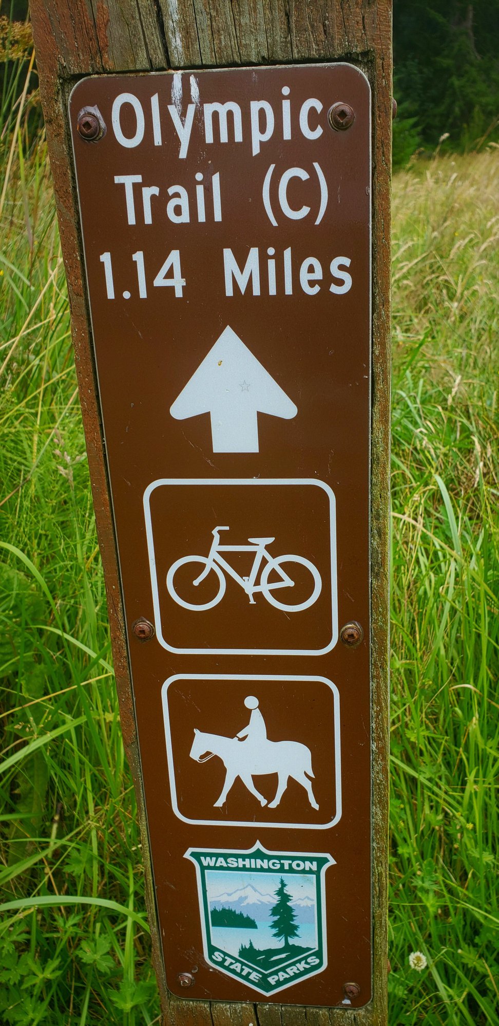
We followed the road to Anderson State Park and we were one of three people in the park at that point of the day. We used the restroom and walked towards the cache on Trail C. It was a pleasant little walk in the forest. We noticed that someone had recently been out here on a horse so we had to avoid the horse poopies as we hiked.


We got to the section of forest and had to leave the trail to find this unique area described on the cache page. Mom and I found the downed tree after we read the hint. The cache owner said that the coords might be slightly off because it's in the woods and it's really hard to get a spot on reading. I told mom, this is the only place it could be based off of the hint. Sure enough, there was the old ammo can. I signed our names and got a picture before walking back to the Expedition.


I am so glad I took the time to grab this one. I can now cross this oldie off my Washington State History caches list. I have several more to go and will probably take me a while. It's too bad no one could really enjoy Anderson Lake because it constantly has toxic algae. Last time I was here, in 2013, it has the same warning. Hmm.
We made our way back to Hwy 20 and followed Nuvi's directions to Fort Worden. I have only been here one other time and that was with Bob and Bev back in 2013 while doing the state park GeoTour. It was a quick visit so I really didn't get to enjoy it thoroughly. Mom and I decided that we were going to visit the Point Wilson Lighthouse first so we drove over to that part of the park. We parked, grabbed the camera and walked over t the lighthouse to explore. Mom enjoys lighthouses and has never been to this one, me on the other hand, has been to this one and several others near this area. Mom took some pictures while I scrolled through my caching app. Yep, there's one here. Point Wilson Lighthouse (GC1GBG9) took us a while to find the correct log it was hidden in. Once I found the location it was pretty obvious where it was. I signed our names, got a picture and put it back exactly how I found it.


Once we were done with the lighthouse, we walked back over to the Expedition and found ourselves a picnic table to eat our lunch at. Mom made herself a tuna sandwich and ate some watermelon while I had my lunchable and some peaches. We used the restroom and then found Take One Leave One (GC5EFG7) but had to wait until some muggles moved before I could get the cache. It was Velcro'd to the bottom of a mini library. There weren't that great of books inside but it's cool that these little free libraries exist. I signed the log, got my photo and put it back before someone saw me.

We walked over to Battery Kenzie and explored the structure. It's in pretty good shape after 100 years considering all the weathering it gets every day from the wind, rain and sun.


I asked Mom if she was ready to go hike up to the bunker area on top of the hill and she said yes. We drove towards the lot that I parked in last time when I came with Bob and Bev and they were coned off. How are we suppose to get in there? I drove to the end of the road and we found parking over by the West Gate. It, however, was going to be a longer walk. Well, we weren't doing anything else today so why not? We grabbed all the stuff we would need and shoved it in a back pack. We started down the trail and took a side trail to try and find a cache but we didn't succeed. I think it was missing. We got back on the main trail and made our way to the main bunkers on top of the hill. We passed by a few people also enjoying what the trail had to offer.
We meandered our way through the trails and onto other trails. I knew where they were but some of the trails weren't labeled. We passed by Battery Walker and took a few pictures while we were here. These Batteries had some great views of the Sound before all the trees grew up.


We continued on the trail to the main attraction up on Artillery Hill. We huffed and puffed it up one of the steep hills we had to climb. I knew we were getting closer because the trees started to thin and open up. We spent about an hour or so wandering around Battery Benson, Ash, Quarles and Randol.


I had mom find the WaStatePks100: Fort Worden (GC4BM8D) cache. It was in the same place I remember it being. She thought the hiding place was pretty cool.

We hiked back the same way we came just so we knew we would end up at the same place where the Expedition was parked. I didn't want to wander the forest lost or in circles. It was quicker on the way back to the parking lot, like it always does and Mom asked if I could drive by the officer's quarters before we left and I told her of course. This part of Fort Worden was in the movie, An Officer and a Gentleman.

We drove to the road we came into the state park on, parked and I ran over to the theater to grab one more cache, What's at the Theater [OPG] (GC6QCAT). The coords were so off and I had to be careful not to let the two boys hanging out nearby on bikes see me searching. I am embarrassed on how long it took me to find the container. It was pretty obvious where it was when I got there. I was distracted by trying to hurry and find it without the boys seeing me. I got it signed and put back in its hiding spot. I walked back to the Expedition where mom was patiently waiting.

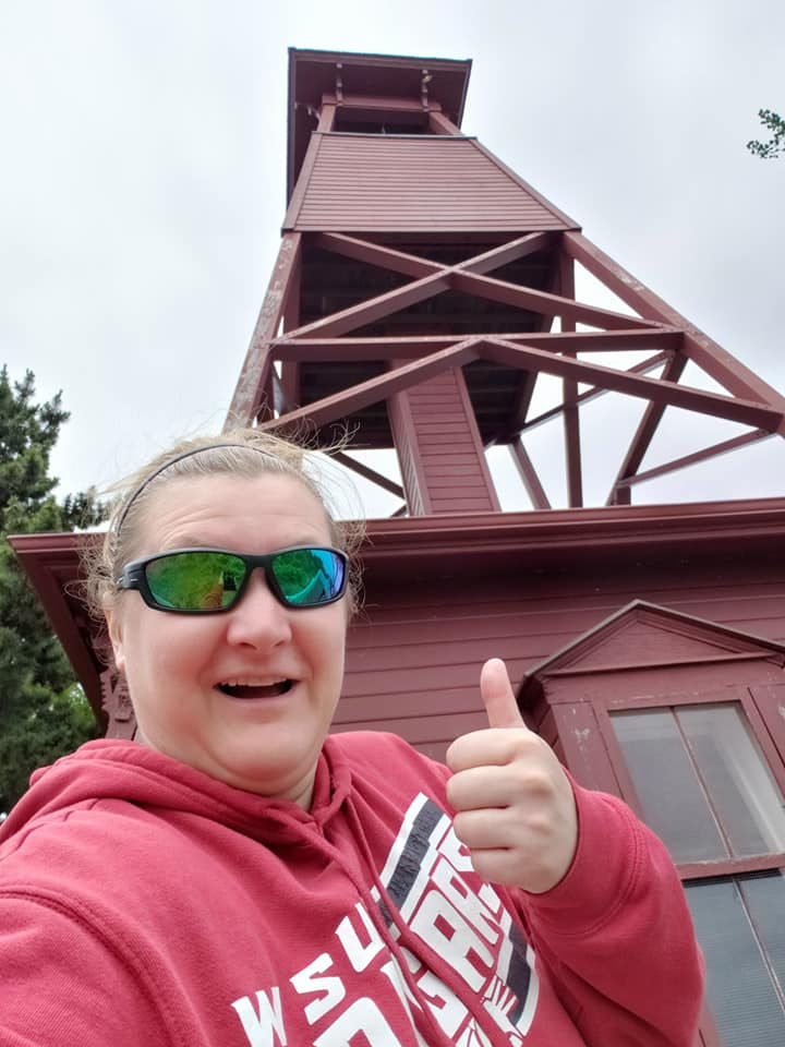
I pluged in the next set of coords. These will take us to the downtown area near the waterfront. The coords were going to take us to the virtual cache, I Stand Alone (GCJN75) which was at an old bell tower with a great view of the Sound. We followed Nuvi's directions as we snaked our way through town. As we reached our destination, we found that this little area was really hard to navigate through since it was literally a tiny road and a small parking lot but we managed. We got out and answered the questions on the cache page. We enjoyed the view from here and took a few pictures.

Mom wanted to check out a few places down on the waterfront so we drove down the hill and found a parking spot. We walked over to the old clam cannery so we could take a picture of the photogenic door Mom saw on Pinterest. The building is now a hotel.

From there, we walked around the water front to the docks and the small park, mostly to find the cache, Pope Marine Park (GC35YK8) and then we walked to all the various shops on Water Street.


I grabbed a few postcards and Mom got her t-shirt for her "traveling" quilt she is going to make once she has enough shirts to finish it. We went into a pirate store, a gift store (where we found Erika a dishwasher clean and dirty magnet) and walked over to the Quimper Mercantile Company to browse for a while. We walked back towards town, saw the historic Haller Fountain and Mom decided she wanted a strawberry shake. We walked to the Nifty Fifty's Soda Fountain Shop, ordered our milkshakes and sat down...social distancing of course.


We both decided we were done exploring and thought we should go back to the Expedition and start heading back towards home. We left town and I grabbed one more cache before we left, Welcome to Port Townsend - Travel Bug Hotel (GC2VJM8) mostly because it was a travel bug hotel and wanted to collect more travel bugs for my own hotel at home. We found a pull off and parked the Expedition and Mom stayed while I looked for it. I found it behind the sign tethered to the bottom of a Douglas Fir tree. I signed the log and was disappointed there weren't any travel bugs inside. Bummer.

Mom and I headed out of town and headed south to our last destination, Fort Flagler State Park. She wanted to go explore that state park because she had never been before. My first time here was back in 1996 with my 6th grade class. We came here for a weekend field trip. Then again with Bob and Bev back in 2013 for the GeoTour and now again, today. It took us a while to get there because we had to drive around the Sound and onto Marrowstone Island. We drove through the entrance and followed the road by memory to a small building containing a public bathroom. We used the facilities and then walked out on the trail to Another Military Outpost [OPG] (GC6QCCM) and the Batteries, Rawlings, Grattan, Revere, Wilhelm and Lee. We spent a good hour-ish here wandering around.


Mom and I walked back to the Expedition and she wanted to go down to the light house and walk along the beach before we left. We followed the road down there but first we stopped at the buildings to show here where we stayed when we came in 1996. I told her some stories I remember about being here. We made our way to the light house.

We spent about a half hour picking up flat rocks and weathered flat driftwood. We were getting hungry so we got back to the Expedition and drove back to Hwy 20 and followed it to the junction of Hwy 101. There wasn't really many places to stop at to eat so we decided to stop in Shelton because most likely more places would be open. We chose Dairy Queen because it was quick and easy and we knew we had to go through the drive thru. We both ordered the chicken strip meal, we asked for ketchup and didn't get any. Lame.
We got to my house around 9 p.m., unloaded Mom's Expedition and she went home. I unpacked my stuff, got a shower and logged my caches. I was so excited to sleep in the next day.
Next Adventure: Geocaching While Heading to Forks


