Sunday, October 14

International Earthcache Day

I saw this a few weeks ago on Facebook:

Celebrate International Earthcache Day on Sunday, October 14 by logging an Earthcache. Find an Earthcache at www.geocaching.com. The 6th annual International Earthcache Day returns, to help kick-off Earth Science Week 2012. Join the Geological Society of America (GSA), which oversees the global Earthcache program, and the American Geosciences Institute (AGI), which organizes Earth Science Week. Explore this exciting and educational Earth science experience which often reveals hidden clues about the earth's formation.  There are more than 23,000 Earthcaches around the globe and a staggering 3,300,000 people have logged those caches to date.  Visit www.earthcache.org and www.earthsciweek.org to learn more. 


I called Bev, we need to find an earthcache on Sunday, October 14!  She wanted details.  I explained to her what I read and she was on board.  Her, along with everyone else who saw it, wondered if we got a badge for logging an earthcache on that day.  I told her I didn't know.  I seriously doubted it though.

We decided to go for the artesian well in Eatonville since that was the closest earthcache, without going out of our way.  I'm really glad we decided to save it for this occasion.

I got a few texts the night before to make sure we had pH strips, a stop watch and some containers to put the water in.  We were all set.

They arrived around nine and we all piled in the car, Mike included.  We headed towards Eatonville.  Our GPS maps lied to us so we had to do some turning around and back tracking, with geocaching who hasn't right?

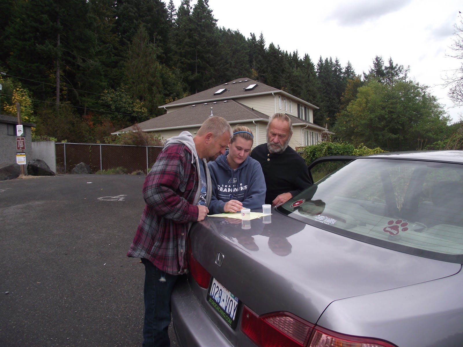
We got to the posted coords and there it was.  It reminded me of an actual well.  The one we did before in Olympia was just a pipe running into a drain.  Bev took a sample of the well water to take home and Bob and I did the actual gallon/per min experiment.  It took seven seconds to get to a gallon of water.

N 46° 53.595 W 122° 17.074
Bev gathering well water to take home.
Me gathering lake water to compare.
Going over our data.
Determining pH and if it was alkaline or acidic.
After finishing our earthcache, we decided to go for a few others in town we haven't gotten yet.  Since Bob and Bev basically cleared out Eatonville, there really wasn't a lot of them to get.  We did find a few to grab though.  

We went to a small park to find one that was suppose to be easy.  Yeah right.  We probably spent over a half hour looking for something that probably wasn't there.  We ended up DNF'ing it.


I had no idea she was taking my picture. I'm surprised.
Bob coming back from bush whacking.
Mike looking in other directions.
We went to the church for one we haven't gotten yet.  We forgot it was Sunday...

Luckily we found it fairly quickly before someone from inside the church came out to ask what we were doing.

Bob stopped at one on the way home that Mike and I haven't gotten yet.  Three more to cross off the Eatonville list. 

Next adventure:  Longview/Kelso/Kalama.

Wednesday, October 10

Cowlitz Caching

The last few days new caches have been popping up down by Vader.  So we decided to do them before they disappeared, since that happens often.  Bob and Bev have already been down here several times so it was hard to decipher which ones they already had, which ones I didn't have and which ones we didn't have together.

They got here around 7 and I grabbed all my stuff and headed to the car.  We headed out towards Tenino and Scotty B's.  When we got there Kenny and Mike were already there waiting in the booth.  We shared breakfast and conversation with them.  Today I tried the french toast.  It was excellent.

We headed towards I-5 and drove south to the Toledo-Winlock exit.  There, we started the I-5 Series by "bearsandme".    We didn't know what to expect.  Most of the series in the area are micros, either film canisters or bison tubes, hiding in trees or stumps.  It was a relief to see some creativity in these ones.

We came across shoes, a teddy bear, cows, bugs, bees, an other assortments of containers throughout our day.  My favorite was the first cow one we found.  It actually mooed.


We continued south down the side road parallel to I-5, stopping along the side of the road grabbing the series.  I had no idea this road was here and it wasn't used very much so that was an advantage for us when we pulled the car over.  We headed towards Toledo and down a road that we couldn't help make fun of.  I kinda wish I knew someone who lived down Fluckinger Road.  We came up with several jokes and some fun names for caches if we lived nearby to hide them along this road.  Fluck yeah!

This is my favorite picture of Bob to date.


Here are a few of the containers we found that day:


 Most of them were pretty easy.  The picture at the bottom, the spider, was hard to find.  We had no hints or clues in the logs so we were just looking for something out of place.  The only thing we knew was that it blended in well.   This was under the trees so our coords bounced all over the place.  We were all over the place too.  I had to leave the trees several times just to get my GPS to stop bouncing around.  It actually worked.  I was within 5 feet of the cache once Bob found it by accident.  This place had so much trash and a very questionable plastic bag.

The next few caches was in an area we've been to so we kind of knew our way around.  There were 6 new ones off of Barnes Drive, west of the Toutle rest stop off of I-5.  This time we drove the roads instead of walked them.  We had a discussion on why we didn't drive them last time.  Bob said the gate was closed.  Bev and I didn't recall there being a closed gate.  I think we just assumed we had to walk around the loop. So we did with two other people and a dog last spring.


 We drove towards the first few.  The first one made us go down a steep hill, the next few were difficult and we managed to find one of them.  The other two were difficulty 5.  We gave them a good search but came up empty handed.  One of them still hasn't been found and it's been out since May.  Here, is where the weather started to improve and the sun came out.  We drove back grabbed two more, one was inside of a bone, which is not an unusual hiding spot in the woods covered in bones and animal carcases.

 
We finished up the woods and moved on towards Castle Rock.  There were still a few Bob and Bev hadn't gotten to yet.  They stopped at the Aloha TB Hotel since it was gone the last time I was in the area.  I dropped off about 12 TB's.  Too bad it was a temporary container, I would have liked to see the original.  We went into downtown Castle Rock and did about three of them, one was a unique multi about a fake missing dog, one was inside a black electrical box and one was at a garden nursery up the hill.  Bob got frustrated because there weren't any more in the area on our GPS's so we headed to Toledo for a few.  There was this park nestled up against the Cowlitz River.


We parked the car and walked the short trail around the lake.  We grabbed the first cache quickly.  We saw tons and tons of small Canadian geese just up ahead.  They were laying along the shoreline.  I had to run and chase them into the water.


They were so upset.  The noise coming from at least a couple thousand geese was deafening.  We headed to the second cache and found it with no problem.


Bob laid down in the grass and was picking sticker bush out of his socks and shoes.  You can see him in the background.  Haha.  We put it back and headed back to the car.  Along the way were five white geese who were very used to being around people.  They expected that we give them food.  We didn't have any so they were really upset with us for walking away.  As a kid, my grandparents had geese similar to them that they let wander the yard, so when we came over to visit we didn't want to get out of the car.  We were chased by them and feared them.  I was hoping that these Toledo geese would not chase me.  Four of them were normal looking and this other one looked like it got stuck in a rototiller or hit by a truck.  It's feathers were all over the place on its body.


 We got back to the car and got a few more before heading back towards home.  We stopped at the Rush Road McDonalds for some dinner.  We got home around 6:30.

Next Adventure:  Eatonville, Wash. for an earthcache for International Earthcache Day. 

Saturday, October 6

Center of the Geocaching Triad

The night before I got a phone call from Bev asking what I was doing this weekend.  I told her I had no plans as of right now.  She asked if I wanna go to Randle to do a bunch of forest caches and get away from the park and grabs for a while.  I asked what time and where do I do my query from.  We exchanged the details and I went to bed.  I was so done with my long Friday.

My alarm went off at 6:45 and I went and got ready.  I already had my stuff put together from the night before so it was mostly using the bathroom and putting clothes on.  She called to let me know they were on their way and my phone didn't ring.  I was in my room doing the final sweep when I heard the deisel truck roll in.  She called again, we're here, hurry up.  I realized I did not load my query onto the GPS so I told her it would be two min before I joined them.  I got it all downloaded and off to the truck I went.

We stopped in Tenino at Scotty B's for breakfast.  We all had small meals just because you never know how they will settle when you're driving down the freeway with no where to stop.

We headed towards Randle with the intention of grabbing Bear's Den, Last of the Mohicans and the others in the area as well as the Center of the Triad.  We went down the road near Glenoma and drove around Riffe Lake.  At one point, while looking at the lake, I noticed an American Flag in the middle of the lake.  It looked like it was strung up a pole, something similar to what someone would have in their front yard.  Then I realized a town once stood where this lake is now.  Maybe it is part of someone's front yard?


Kosmos is an unincorporated community in Washington, United States. It was established in 1904 with a grocery store and a post office. Kosmos reached its heyday in the 1940s, when mills and logging camps dotted the landscape. Kosmos was abandoned in 1968 when the Mossyrock Dam was completed. The Cowlitz River rose behind the dam, forming Riffe Lake, which completely submerged the town of Kosmos. The remains of the town are periodically exposed when the lake recedes during regional droughts.

We went as far as we could when we saw that they road was closed ahead due to a fire danger warning.  We were so upset we couldn't do the ones we had planned to do.  I don't recall there being any fires down this way.  Where were the fires at?  We turned around and headed to the ranger station in Randle to see if we can find out more about these fire danger warnings.  We got to the ranger station and checked out the list of closed roads.  We decided to go for the center of the triad and checked to see if the roads to that was open.  They were.  Score.


We headed down FS25 and grabbed a few caches along the way.  Iron Creek campsite was one of those places because there were two inside the gate.  We had to walk to them because the campsite was closed for the season.  We headed out to the first one.  They were along the Cispus River on the backside of the camp.  Bev decided to stay behind when we ran after it.  Bob and I found the first one and he decided to go look for Bev.  She went back to the truck.  I walked along the trail and took pictures.


 I met up with Bob at the next one a little over a quarter of a mile down the trail.  We had a hard time coming up with this one.  The coords were so bad.  By the time I found it, Bob was basically scaling the cliff right below next to the river.  I yelled down, found it!  My GPS said 80 feet.  Wow.  He saw where it was, we signed it and went back to the truck where Bev was waiting.  We headed back down FS25 and looked for FS26 to head to the triad.  I had some time to look at my maps.  In the mean time, we saw this awesome view of Mount Rainier from a side we never see.


We went further south after we figured out where we needed to be.  Since we were down here, we grabbed another cache before we turned around and went back to where FS26 was.  I can't believe the road was not marked.  How would you know if you've never been here before and there were so many forest service roads that snaked all over the place?  I guess you have to back track and be okay with it.  This road was so long.  We could not believe this cache was so far back here.  We were literally 5 miles north from Mt. St. Helen's Spirit Lake.  We grabbed two along the way.  We almost had a head on collision with another truck flying down the one-lane paved road.  I'm so glad Bob stopped when he did.  There were lots of cars for how out in the boonies this was.  We reached FS2612 and had a straight shot of the final cache location.  The road turned into gravel and had several hard core potholes.

We arrived to the cache zone, turned the truck around and went down the short hill to where the cache was hidden.  We took pictures and signed the log.


To find and log this cache, you had to go to three specific caches:

GCK25B: Groundspeak Headquarters, Seattle, Wash. (4.29.11 and 5.1.12)
GC300N0: Project Ape Cache: Mission 9 Tunnel of Light Reclaimed, Snoqualmie, Wash. (8.21.11)
GCGV0P: Original Stash Tribute Plaque, Estacada, Ore. (6.26.11) 

These three completed the Triad Challenge (GC1WYHN).

We headed back because Bev had plans for this evening with Shari.  So we tried to get home on time.  We grabbed one more before heading back to Hwy 12 and then to I-5.  The day before I forgot my wallet when I was with grandma in Centralia when I went to the Under Armour Store.  I put it on hold so I could get it the next day.  We had enough time to stop by today, pay and pick up my stuff.  I was dropped off at home and the day went well considering we had to change our game plan.  Maybe we can grab the ones we wanted to before the weather gets cold and rainy.


Next adventure:  Cowlitz County