Saturday, September 16

Nordic Northwest Troll, GC17, Boring Brewing Company and Papa Pete's

I got to talking to Mom one evening and she expressed interest in visiting the NW Trolls that have been popping up over the Pacific Northwest.  I noticed that the next few weekends in September were going to be nice and I wanted to drive down to Oregon to get GC17.  I asked Vicki and Brian, our geocaching friends The SuperKnotts, who live down in Vancouver if they've found that cache or not yet.  They said they did in 2018 with one of their friends who was in town.  Well, now I've got to find someone to go with me.  Ben was on shift that day, I didn't want to make Bev do a hike like that with me, since she is not an "off road vehicle", and the time I was there to grab GC12 with Ray in 2013, he and Brenda already found it a few weeks prior, and we didn't have time to go walk up to it.  It sat on my list for the next ten years. 

Mom and I planned a trip down to Oregon to see the troll and to grab GC17.  I was surprised she wanted to go hiking with me again after the Mailbox Peak trip a few weeks ago.  I assured her it was nothing like the hike we went on that day.  We asked Dad if he wanted to go, and he said no.  I told her that I would be at her house around 8 a.m. and to be ready to go.  The night before, I got my hiking stuff together, made sure all of my random things were in my orange backpack and gathered up my car GPS because we would need it.

Ben woke me up as he was leaving to head to shift in Tenino, and I went back to sleep until my alarm went off at 7.  I rolled out of bed, got ready, grabbed a chewy bar, water and was out the door by 7:30ish.  I headed into Rainier and picked up Mom.  She was actually ready to go.  I got the address to the troll into the Nuvi.  She tossed in her backpack, hiking pole and hiking shoes and we were off!

We drove down Hwy 507 through Tenino, into Grand Mound and hopped onto I-5 south and traveled over 90 miles down to the Washington and Oregon border.  It's been a while since I drove over the I-5 bridge into Portland.  Traffic was minimal because of the time of day we went through, but sometimes it can be a crapshoot.  At the junction of all the freeways and highways merging into one, we got in the correct lane to continue down I-5 south.

We took Exit 296B (the Multnomah Blvd Exit), followed that road through some residential area and then turned left onto Oleson Road.  The Nuvi told us where to turn.  We pulled into Nordic Northwest and there wasn't that much parking available, but we did manage to find one after a few minutes.  We got out, locked the Escape and walked over towards the troll. 

Ole Bolle, the troll who lives on the Nordic Northwest campus, is part of a public art exhibit, Northwest Troll:  Way of the Bird King, that includes six trolls created by Danish recycle artist Thomas Dambo.  Fashioned out of recycled materials, the art installations turn trash into treasured trolls who tell us a tale of protecting nature and honoring our land.

In Nordic mythology and folklore, trolls are known to be fierce protectors of nature.

We followed a woodchipped trail that led us to Ole Bolle, the troll.  He had the roof pried up and was peering into a small building.  We took several photos while we were there.  I saw there was an Adventure Lab and Mom, and I spent some time doing all ten waypoints and checking out the Fogelbo buildings on the campus. 


It was pretty cool to come see the troll in Portland.  There are others, but they are all up near Seattle. There is one at Lincoln Park in West Seattle, one in Ballard, one in Issaquah, Bainbridge Island and Vashon Island --we would have to take a ferry to see the one in Vashon.  The rest are doable by car.  We wandered around for another half hour or so before deciding to head to Sandy for our hike.


Mom waited in the Escape while I went to go grab a cache across the street at the bus stop.  Fogelbo (GCACXJQ) was fastened on the back side of the bus stop.  The ammo can was decorated with a Swedish flag and had a lock on it.  The combo for the lock was on the cache page.  I got the lock off, opened the container, signed my name and was disappointed there weren't any cool things inside of it.  I locked it back up, stuck it back in its hiding place and walked back to the Escape.


I plugged the coordinates into the Nuvi for Wildcat Mountain near Sandy.  Like I mentioned before, I have been out that way with Ray, back in 2013, to grab GC12.  He and Brenda already had GC17 when I went with him so, I would have to do GC17 another day with someone else.  I really could not believe it had been ten years, so much has happened since then.  

The night before, I was debating whether to go up and grab it via the "short cut" or, go the longer way around.  I read through the logs, and several had mentioned people out there shooting targets and the "short cut" was most likely going to be riddled in shooters due to the summer-like weather we were still having.  I decided to just to the 5-mile hike just to be safe. 

I was curious to see what route the Nuvi was going to take us from Beaverton to Sandy.  It took us south down through Tualatin, where we got onto I-205, drove past Oregon City and up to Clackamas and onto Hwy 212, east through Boring. We got into Sandy, and I started to recognize some things from last time.  We followed Nuvi's directions, got off of Hwy 26 and onto SE Wildcat Mountain Dr.  We followed it for several miles all the way to the Douglas Trailhead.  

I stopped at one of the wide spots in the road to grab 1217's Front Door (GC15V8K).  I hopped out while Mom stayed in the Escape.  It was a quick grab from a stump.  I signed our names, got a photo and put it back.  You could hear several people shooting off in the distance.

We continued up to the trailhead.  When we got there, I noticed it had changed a lot since the last time I was up there.  The trees had grown up a lot and there were more rocks piled up, attempting to keep vehicles off of the trails. I parked right where Ray and I parked ten years ago.  Mom and I got our hiking socks and shoes on, our backpacks, hiking poles and peed behind the bushes before we went.  I had to remember exactly how Ray and I got to the actual trail. 


I told Mom that I remembered walking up this "pipeline" looking service road.  It had a lot of trenches and berms worked into the landscape and even some downed trees and stumps.  Again, trying to keep vehicles off of the trails. Mom followed me while I navigated our way to the trail via my geocaching app. We left the parking area around 12:15. We will see how long it took us to hike back. 

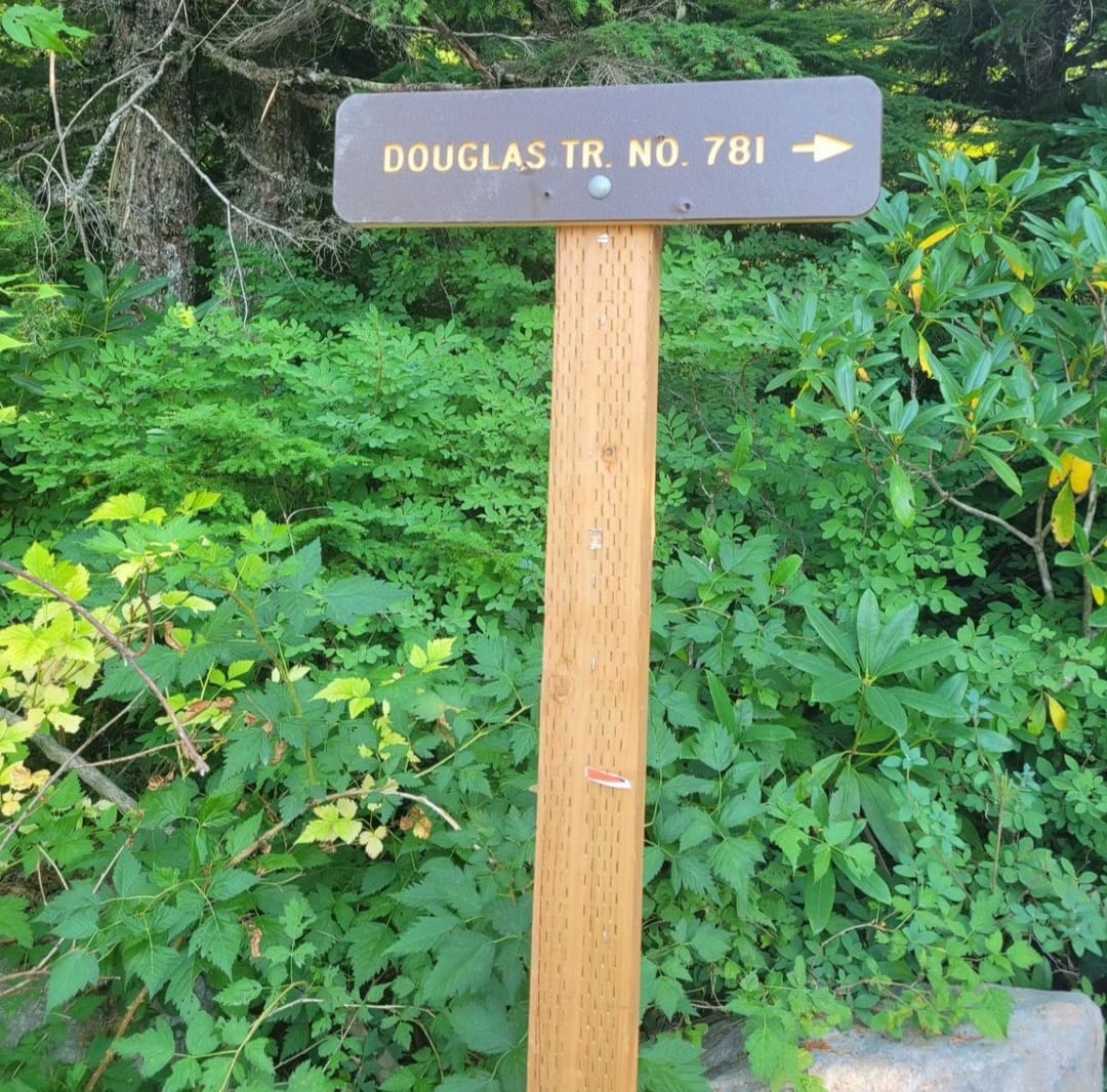
We reached the rock pit and continued east along the trail when it split off.  GC17 is east and GC12 was west.  The Douglas Trail followed the ridgeline.  We walked past an array of different plants and trees including a section of Madronas, small and large firs, rhododendrons and bunch grasses.  As far as we knew, we were the only ones hiking up, but you could still hear echos of gun shots in the distance. 


As we got further into the hike, we started to see the landscape change into a forest of tree trunks with boulders, downed logs and more open spaces.  This is where we gained a little bit of elevation in our hike.  We had to stop a few times, but it was nothing like Mailbox Peak, Mom was able to take shorter breaks and hike in longer chunks.  It was more of a gradual gain than a sharp vertical gain.


We reached a junction in the trail and took McIntyer Ridge north towards GC17.  We finally reached the tree line and was able to see blue sky and some of the other ridges and hills in the distance. We trudged on and kept letting Mom know that we were getting closer to the top and to the cache we came up here for. I am so glad we waited for a nice, clear day to go up there.  We started seeing Mount Hood poking out of the trees and hills.


We got closer and closer to GC17 and I was getting excited!  Another Jasmer cache off my list!  Mom and I stopped to take a few pictures of Mount Hood in the distance.  We had about 200 feet to go until we reached the intersection of the two trails.  There was a sun-bleached tree snag, a beat-up bench and a great view of Mount Hood.  For some reason my phone decided to restart itself and I did not have great service up there, so my GPS failed for a while.  I had no idea where I was looking for the cache.  I spent probably a good half hour searching everywhere while Mom sat on the bench and ate her sandwich, lol.  I even got raked across the leg by a bush that grabbed me. 


My phone finally found a hint of a signal and updated itself.  I was able to see where I was and could access the hint.  I was searching in all the wrong places.  Where the trail intersects, I walked down the hill to a stump and there it was, Geocache 7/21/00 (GC17).  It wasn't the original container like GC12 was, but it will do.  I found it 23 years and about two months after it published.  I was in between my sophomore and junior year of high school.  Soooo many things have happened between that span of time.  It was crazy to think about it. 


I got our names on it and because it was a special cache, we weren't in any hurry and I remembered to bring my stamp, I stamped the Cougar logo on it.  We took various photos with it, I ate my sandwich with it, lol and then it was time to put it back and make our way back down to the Escape.  


The hike back down was much quicker.  We did take some time to enjoy the surroundings and the beauty of the Pacific Northwest.  In my head I thought about the two hikes we've taken in September; this one was by far a breath of fresh air compared to the one we took earlier that month.  I know Mom was happy to be able to enjoy the hike without having to be exhausted and rescued again, lol.  We arrived back at the parking area around 3:45. The hike was about 5+ miles roundtrip and it took us about 3.5 hours. Not bad. 


We used the bathroom behind the berm and out of view of others, just in case someone happened to drive up, took off our socks and shoes, put all of our gear into the back of the Escape and headed back down into Sandy.  We listened to WSU beat up on Northern Colorado on the radio. Mom wanted a hot fudge sundae from Dairy Queen, and I wanted a beer from the Boring Brewing Company.  We stopped at Dairy Queen first, went inside and Mom got her hot fudge sundae.  We drove across the street, found a parking spot and went into the brewery.  The lady was very nice at the counter, and I ordered The Hoppy Blonde. I thought their logo was hilarious. Mom finished her sundae while I drank my beer.  We chatted about random things as we sat there in the remaining sunshine. 


I finished my beer, brought the pint glass to the counter and headed out.  Mom wanted to go to a JoAnne's, so we typed one into our phones and found one in Gresham.  We followed the directions to a little shopping center.  They were having a really good sale on just about everything, including fabric.  Mom bought a couple different patterns of fabric so she could finish some baby quilts. We saved a ton of money on the sale, plus not having to pay sales tax.  The Cougars defeated the Bears 64-21.  I found another radio station that was playing the Duck game.  They were beating up on Hawaii and ended up winning 55-10.  

We got back on to I-84, hit the junction at I-5 and headed north to Washington.  Mom wanted Papa Pete's for dinner, so we stopped at the one in Ridgefield.  It was semi-busy, a kid's birthday party just got done and was at the tail end of it.  We ordered a large pepperoni and black olive and a side salad with Thousand Island dressing.  We found a place to sit, I went to the bathroom to wash my hands, and we shared the salad while we waited for our pizza to get done.  Once it came out, we ate, and it definitely hit the spot after a long day.  We were there for about an hour.

We stopped at the nearby Arco for some gas before hitting I-5 again.  We listened to the Mariners play the Dodgers as we drove north...they didn't win.  When we got closer to Chehalis, I asked Mom if she needed to stop for anything and she said yes, so we stopped for about an hour, while she picked up the things she needed. 

We got into Rainier around 10 p.m., dropped Mom off and I headed home.  I got home just before 10:30. I got in a shower, logged my caches, talked to Ben and then went to bed.  I always have a hard time during this part of the year because I know that summer is leaving, and fall is approaching.  It just takes so long for summer to return. 

Next Adventure:  Spokane Trip:  Traveling to Spokane, Hanging with Brenda and Ray, Geocaching and Heber Hatchets

Saturday, September 2

Mailbox Peak

I've mulled over doing this hike for several years now.  Ben and I tried doing it back in 2014, but instead, we spent our afternoon in a doctor's office because he woke up that morning congested and was wheezing.  His cough was bad, and we needed to see what was going on.  His job at the time, working security at the Lucky Eagle Casino in Rochester, he was around cigarette smoke-filled rooms and other various smells.  He ended up having a sinus infection and was given some antibiotics. 

Ben has done this hike before, back when he was in the fire academy and at the facility near the bottom of Mailbox Peak. He and a bunch of other cadets would run up the old side of the trail and back down. 

We spent the next few years trying to better our lives and didn't have time or the money, or reliable vehicles to do extra things at that point.  It took a lot of patience, doing things we didn't want to do and ate up a lot of valuable time we can't get back, but we did it.  

I knew this hike was going to be hard but didn't know it would be THAT hard.

Somehow, I talked Ben and Mom into doing this hike with me during our long Labor Day Weekend.  We chose to do it on a Saturday, so we would have a couple days to recover.  I mostly wanted to do it for the one cache I needed for my Jasmer grid.  Plus, it would be cool to see the mailbox at the top of the peak, so that is what I planned for us to do.  I did spend some time reading the WTA and All Trails logs and people's personal stories on the internet.  I thought, if that person could do it, so could I.

I got our stuff ready the night before.  I made sure we had enough supplies and stuffed them into my orange backpack.  I put our hiking poles, hiking shoes, extra clothes and first aid kit into the Edge.  The next morning, we woke up at 5 am.  I had Mom be here around 6:30 so we could leave as soon as possible.  I was worried we weren't going to get one of the parking spots, since it was limited to 40 or 50 cars max, and this is a popular hike.  I had Ben drive the Edge because the Escape had been having battery cable connection issues over the past couple months and my appointment with Ford wasn't for another couple weeks.   

We loaded up Mom's stuff and headed out.  We got onto I-5 and headed north and merged onto Hwy 18 at Federal Way.  It was pretty much smooth sailing through Auburn, Covington and up Tiger Summit.  They were widening the road after the summit so, there were some coned off sections to where we had to move down to one lane all the way to the I-90 on ramp.  We got onto I-90 and drove east towards North Bend and the mountains. 

We got off of I-90 at the exit for the unincorporated town of Tanner where all the trucker gas stations are.  I remember stopping off there over ten years ago to grab a few caches coming home from some sort of adventure on the east side of the state.  We followed Ben's GPS along SE Middle Fork Rd all the way to the trailhead parking.  I was nervous the entire time.  I was really hoping there would be a parking spot left for us.  As we rounded the corner and made it to the lower lot, there were two spots left, we grabbed the first one immediately.  I doubt there were any in the upper lot near the bathroom.  We displayed our Discover Pass, grabbed our poles, put our hiking shoes on, grabbed our water, backpacks (full of food and supplies) and walked up to the upper lot to use the restroom one more time.

The weather was coolish, but not cold, throughout most of the morning because we were in the tree cover. I wore a sweatshirt while we were in the trees.

We all took some deep breaths and walked up to the new trailhead to start our hike.  We decided we were going to go up the new trail (the easier trail) and down the old trail (harder trail).  The new trail was approximately five miles but does not account for all the switchbacks, so it seems longer than five miles.  Yikes, that is going to wear us out before we even get to the super hard part. 

I wanted to pick up the geocaches along the trail.  There were ten altogether, but we did not get the one at the trailhead, Mailbox Peak Trailhead (GC8Y6QC) because someone had DNF'd it previously, or the one just off the service road near the old trail, Peaceful Guardian Troll (GC947EN) because it got too dark when we were done.

We started up.  I knew we were probably going to have to stop a lot just because of the serious gain in elevation and the old trail was "easier" than the old trail.  We all did do some hiking this season but after doing it, we were definitely not in tip top shape.  


I kept saying that we had all day, meaning that as soon as we got to the top, it would be a breeze coming back down, right?  I really thought we would not be there all day.  

But we were. 

We got about a fourth of the way up, which is roughly 1840 feet in elevation, and I wanted to stop to grab 1/4 Mailbox Peak (GC5DZ4X).  The previous cachers could not find it but we attempted because we walked all this way already so why not?  Ben and I started looking.  If the cache was there, it was not hidden back to where it originally was placed, due to the hint.  Mom noticed something from afar and directed us to it.  It was the cache!  Yay!  Mom is great at finding caches too!

We got our names on it, a photo and put it back exactly how we found it.  We trudged on.  There were so many switchbacks!  We would get up one, take a break so we didn't kill Mom, go up the next switchback and take another breather.  This really was going to take all day and we had no idea how much longer we had until the next section of the trail.  


After putting a mile or so behind us, we got to the next cache, Mailbox - The Easy Way (GC5DQGA).  This one was easy to find.  It was right off the trail, about ten feet, near a stump. We all took a breather while I signed our names on the logbook.   

We continued up.

I ate one of my chewy bars as we walked this section.  This was the only short distance between two caches.  We approached 1/2 Mailbox Peak (GC5DZ4V), which is roughly 2840 feet in elevation, and we were starting to feel the burn.  I told Mom that we were halfway there!  I got a tired look back from her, but she kept at it.  

There were a lot of other hikers and hikers with dogs walking past us.  Some kept to themselves while others encouraged each other to keep going.  A few of them gave Mom nuggets of affirmations. I wish there were more people like that in this world.  We got through a bunch of the switchbacks, resting with Mom, when we finally got up to the cache, 3/4 Mailbox Peak (GC3KZ5B), roughly 3840 feet in elevation.  On the map, it didn't look like we were that far away from the top. This is also where the new and old trail intersect. 

The coords to this cache jumped around a lot for me.  It took me a few minutes to find it. I got our names on it, took a quick picture and put it back.  I wanted to start the final quarter up to the top.


I took the hard way up to the boulder scramble while Mom and Ben took the easier way around to the boulder scramble. I was no longer shaded by the trees, so I took my sweatshirt off.  It was pretty hot outside...about 80+ degrees that day.  I started up the boulder scramble.  

You could literally see where everyone had walked throughout the years.  A brown colored trail snaked up the rocks. I was determined to find the cache. Check the Mail! (GC994), which is the reason why I wanted to come up there.  It would get me one cache closer into finishing my Jasmer.


I misread the cache page, and I was sent on a wild goose chase, which used up precious energy I needed for the final summit to the mailbox. I realized my mistake, walked back to the boulders, where I met up with Ben and Mom.  I immediately spotted the ammo can hidden amongst the boulders.  After finding this one, I now have two more caches to find, one in Oregon and one in Utah.  I really wanted to go to Utah this past summer, but it didn't work out.  It will have to be another time. 


Then came the hardest part of this hike.  The last quarter of a mile was absolutely brutal.  All of us had to stop a lot.  This part of the trail had a grade of 60%.  Ben managed to monster truck his way up quicker than Mom and I had.  I literally had to stop a few times because I was feeling lightheaded and didn't want to faint.  I can't imagine how Mom was feeling.  She was literally putting one foot in front of the other a few feet, stopping and resting.   

It is almost unheard of to have a popular trail this steep.  It's partly because it was never meant to be a well-trafficked destination. The Department of Natural Resources (DNR) has on record the local legend: The idiosyncratic locale was birthed on the 4th of July weekend in 1960, when Seattle postman Carl Heine lugged a mailbox to the rocky peak.  He challenged the youth at the nearby Lutheran Valley Camp to summit and sign the register tucked inside the mailbox as proof of their success. The old trail is a product of their footsteps as they picked the most direct path upward - far from the careful planning around the drainage and erosion logistics that go into trail creation today.   

The Leave No Trace principles seemingly disappear into thin air, as the mailbox is stuffed with items left by hikers: beers, energy drinks, notes to current and past loved ones, postcards, stickers, candy bars, first aid kits, little trinkets and stuffed animals.  Some take it to a new level, hauling up challenging loads like a fire hydrant, a newspaper box, rowing machine or a LimeBike.  DNR, the agency charged with maintaining the trail, merely asks hikers to enjoy the route up and down with those unwieldy items.  In other words, hike that crazy back out.

Maintenance of the mailbox is a collective effort, often led by good Samaritan hikers who pack out excessive trinkets or replace the whole receptacle from time to time.  DNR estimates there have been 15 different mailboxes throughout the years, including the brief residency of a wacky orca-shaped "whalebox."  DNR also oversees trail maintenance with partners like Washington Trails Association (WTA), which has been out to improve the area over 50 times since 2008, there is no designated keeper of the mailbox.  But for all the trail demands, it remains a regional favorite and a rite of passage. 

I kept going as fast as I could.  I made sure to look behind me to make sure Mom was still doing okay.  She was inching her way up at her own pace.  I got closer and closer to the top.  I could see Ben up there already relaxing with the view of the valley down below.  I didn't realize that Ben had Mom's backpack on, so that meant he had her water too.  Uh oh.  

I finally hoofed the last 500 feet to the top.  Man, that was brutal.  Probably one of the hardest physical challenges I've ever done.  Then I thought to myself, if I had a hard time, Mom was probably having an even harder time.  Other hikers kept walking past us, and I asked if they saw a lady wearing a crab shirt that they passed.  They all said they couldn't remember because they weren't paying attention.  I thanked them for the information anyway.  We took a few pictures, looked at the views and then Ben and I sat down to eat our sandwiches and watched for Mom down the hill.  Ben finished his sandwich, and I asked him if he could walk down there to see where she was. 


He walked down and she wasn't that far from the top.  Ben handed her some water, and she finally made it to the top...about a half hour after Ben and I did.  It was approximately 5:45. We got some photos of Mom with the mailbox and as she ate her food, we looked for Mailbox Peak (GC4M6PK).  We chatted with other hikers as we rested.  I could not believe we made it up there.


 We were hoping the way down would be quicker than the way up.  We were wrong.  

We got started down and the 60% grade wore on our legs.  My quads, knees and toes were getting the brunt of it.  We had to break the hike down into sections to make it less daunting.  We made it down the steep part, Mom took a few breaks and Ben wore Mom's backpack just so she didn't have the extra weight.  We got to the boulders and when we all got to the bottom, we all took a bathroom break before hitting up the next section of the trail.  

We got to the old and new trail junction and foolishly chose the old trail for the well-rounded experience of Mailbox Peak.  We started down and the trip reports were correct, there was not a real defined trail, it was just a make your own path as you hiked down. We all did okay but seriously questioned if we were heading the correct way down.  


We got about halfway down before Mom really started to get tired.  I got down there quicker while Ben walked with Mom, so I could have some time to search for Half Way Up Mailbox Peak (GC16ZRV).  It took me a while to find it because the coords were way off.  I expanded my search and made the find, finally.  By the time I found it, Mom and Ben caught up to me.  I got our names on it, got a photo and put it back.  

Two guys in their 20's, hiked by us.  They looked like they were not struggling at all getting down.  Oh, to go back and be in my 20's again.  They told us good luck as they got further and further out of sight. 

It started becoming dusk and slowly getting dark around 7:50 p.m. that day.  I was getting worried because I didn't want to be on the mountain when it got dark.  We still had a ways to go, and it was getting harder and harder for Mom to keep up with us.  I told her the last cache was coming up soon and we could rest. 1/4 Mailbox Peak (Old School) (GC3KX5A) was the last cache of the evening.  It was getting darker, so it made it harder to find this one, but I managed with my phone.  I signed our names but was not able to get a picture, due to the darkness.

At this point, Mom's body started to not work anymore, and we helped her down as far as we could go.  She started not to be able to make coherent sentences as she tried to speak to us.  That was not good.  We found a place to sit down, and Ben called the fire department in North Bend.  I am so glad we had cell reception on Mailbox Peak.  He explained to them that we had a person in our hiking group who is exhausted and absolutely cannot move anymore.  Mom's legs basically gave up on her.  They asked us several questions, asked where approximately on the mountain we were, including which trail we were on, and they will send some people out.  We thanked them and stayed right where we were.

Ben decided to head down so when they arrived, he could relay information to them.  Ben took Mom's backpack and walked down.  Mom and I sat there and waited.  It was now dark, and I am glad phones have a flashlight on them because the flashlights we had in our backpacks didn't work all that well.  It was still very warm outside for it being past 9 p.m. and I was still wearing my tank top.  An older man, who we passed earlier at the boulder scramble (we were going down and he was going up) caught up with us with his hiking poles and head lamp on.  He asked us if we were okay, and we told him yes and we had help coming.  He continued his way down.  

Shortly after, we heard people and then started to see head lamps coming up the trail. I made sure to shine my light so they could see us.  Once they got to us, there were three of them, they immediately started to take her vitals. They asked her questions, took her temperature, oxygen levels and took blood from her finger to check her blood sugar.  All of those tests were normal.  She just said that her legs gave up and it was hard for her to keep walking.  One of them asked if they all helped her if she could go a little further down the mountain so it was easier for Search and Rescue to help get her down. She said she would try. I texted Ben to let him know the EMT's were with us.

Mom, with the help of the three EMT's, slowly walked down the mountain.  I followed behind them chatting with them as we went along.  We probably made it down the trail another 500-1000 feet before we stopped.  Mom literally could not move under her own power anymore.  We heard and saw off in the distance more talking and head lamps.  They were coming towards us.  One of the EMT's said that was Search and Rescue.

I stayed out of the way as the EMT's and Search and Rescue prepared to get Mom strapped to the litter (basket).  She laid down, they got her secured, they attached the "off road" wheels to it, briefly talked about who was going to work the first, second, third, shifts of maneuvering the basket down the trail.  One of the Search and Rescue guys took the lead (a rope they attached to a large tree and the basket as a break, to keep everyone safe just in case the basket got out of control).  Once the rope ran out, they would stop, attach it around another large tree and do it all over again.  I walked down behind everyone and tried to stay out of the Search and Rescue's way.


The Search and Rescue team comprised of about 10-12 young men and women, and they were very well trained.  I was impressed on how professional they were, and they worked very well together.  They were very enthusiastic and probably were glad to hear someone needed rescuing. They probably don't get to do this very often but when they do, they go all out.  We got closer and closer to the end of the trail because the trail started to flatten out.  I didn't realize that we were still pretty far away from the end where Mom decided to stop, sit down and wait for help. 

I started to see the lights from the various aid vehicles up ahead.  At this point my legs felt like jelly and I was really using the hiking poles for support as I continued walking.  We got to the service road, and I didn't see Ben, he was probably by the parking lot, chatting with the other crew from the fire department.  They loaded Mom up in the aid unit while I walked down the service road with the rest of the Search and Rescue team.  I could not wait to get into the Edge and leave this mountain. The aid unit stopped, and they told me to get in assuming I was exhausted and needed to rest.

We got to the gate, they helped us out and I was right, Ben was talking to the crew and had the Edge pulled up in the upper lot near the bathroom.  We thanked the North Bend Fire Department and the Search and Rescue team for coming to help us.  They told us that it happens quite often, and this wasn't the first nor the last.  They also said that they would rather come rescue someone before it turned into an injury or a missing person's case. Mom got their information so she could send them a thank you card.  I went to the trunk, ripped off my hiking shoes and socks and put on my flip flops.  I grabbed a Pepsi Zero because I needed some caffeine, and I sat in the passenger seat wanting to head back towards home.  Both Mom and Ben thanked the fire department and Search and Rescue again before leaving.

We all wanted food, but it was midnight, and we weren't sure what was open.  We got onto I-90 and drove to North Bend to see if that McDonald's was open.  It sadly, was not.  We got back on I-90, and I looked on my phone to see if there was an open McDonald's nearby.  We got onto Hwy 18 and drove into Auburn.  We got off in Auburn because the internet told me that a McDonald's was open.  It wasn't.  Ughhh!

We followed Hwy 18 to I-5 and got off in Federal Way to see if that McDonald's was open and it was!  We ordered food around 1:05 a.m. and could not wait to put it in our mouths. We all didn't realize how hungry we were.  Ben got a Big Mac and Mom, and I ordered the two-cheeseburger meal, we all got fries and water.  It was 30 bucks for fast food.  I remember when I was in high school a medium meal off the regular menu was under $5!  We didn't care, we deserved McDonald's after a day like that! 

I texted our family chat around 1:10 and Dad was the only one who responded.  Ben and I switched seats in Lakewood so I could drive, and he could eat his food.  I had a hard time getting out of my seat after sitting for about an hour.  As we got closer to home, Mom said she didn't feel safe driving herself home, so we took her home.  I dropped her off at 2:15, helped her bring her stuff in, briefed Dad on the day's adventure and then Ben and I got home around 2:40.  We both got in a well needed shower and then passed out until almost 11: a.m. the next morning.  I literally had to roll out of bed because I could not move my legs. 

We was wild!

Notes on the day:

We were on the mountain for 16 hours.

We were super sore for the next four days.

Mom's toes and toenails were bruised for the next 6-9 months.

Mom ripped a hole in her pants, and we thought it would be funny to sew it up with a mailbox patch.

We probably will never do that hike ever again, once was enough.

Two more caches to complete my Jasmer, GC17 (Oregon) and Potter's Pond (Utah).

The hardest hike I have ever done in my life and Mom will probably not trust me to take her hiking again.

Every time I think of Mailbox Peak, I get a little PTSD that creeps up, but glad to get it out of the way.

We now have that "rite of passage" under our belts.

Next Adventure:  Nordic Northwest Troll, GC17, Boring Brewing Company and Papa Pete's