My alarm went off at 6:45 and I went and got ready. I already had my stuff put together from the night before so it was mostly using the bathroom and putting clothes on. She called to let me know they were on their way and my phone didn't ring. I was in my room doing the final sweep when I heard the deisel truck roll in. She called again, we're here, hurry up. I realized I did not load my query onto the GPS so I told her it would be two min before I joined them. I got it all downloaded and off to the truck I went.
We stopped in Tenino at Scotty B's for breakfast. We all had small meals just because you never know how they will settle when you're driving down the freeway with no where to stop.
We headed towards Randle with the intention of grabbing Bear's Den, Last of the Mohicans and the others in the area as well as the Center of the Triad. We went down the road near Glenoma and drove around Riffe Lake. At one point, while looking at the lake, I noticed an American Flag in the middle of the lake. It looked like it was strung up a pole, something similar to what someone would have in their front yard. Then I realized a town once stood where this lake is now. Maybe it is part of someone's front yard?
Kosmos is an unincorporated community in Washington, United States. It was established in 1904 with a grocery store and a post office. Kosmos reached its heyday in the 1940s, when mills and logging camps dotted the landscape. Kosmos was abandoned in 1968 when the Mossyrock Dam was completed. The Cowlitz River rose behind the dam, forming Riffe Lake, which completely submerged the town of Kosmos. The remains of the town are periodically exposed when the lake recedes during regional droughts.
We went as far as we could when we saw that they road was closed ahead due to a fire danger warning. We were so upset we couldn't do the ones we had planned to do. I don't recall there being any fires down this way. Where were the fires at? We turned around and headed to the ranger station in Randle to see if we can find out more about these fire danger warnings. We got to the ranger station and checked out the list of closed roads. We decided to go for the center of the triad and checked to see if the roads to that was open. They were. Score.
We headed down FS25 and grabbed a few caches along the way. Iron Creek campsite was one of those places because there were two inside the gate. We had to walk to them because the campsite was closed for the season. We headed out to the first one. They were along the Cispus River on the backside of the camp. Bev decided to stay behind when we ran after it. Bob and I found the first one and he decided to go look for Bev. She went back to the truck. I walked along the trail and took pictures.
We went further south after we figured out where we needed to be. Since we were down here, we grabbed another cache before we turned around and went back to where FS26 was. I can't believe the road was not marked. How would you know if you've never been here before and there were so many forest service roads that snaked all over the place? I guess you have to back track and be okay with it. This road was so long. We could not believe this cache was so far back here. We were literally 5 miles north from Mt. St. Helen's Spirit Lake. We grabbed two along the way. We almost had a head on collision with another truck flying down the one-lane paved road. I'm so glad Bob stopped when he did. There were lots of cars for how out in the boonies this was. We reached FS2612 and had a straight shot of the final cache location. The road turned into gravel and had several hard core potholes.
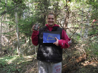
We arrived to the cache zone, turned the truck around and went down the short hill to where the cache was hidden. We took pictures and signed the log.
To find and log this cache, you had to go to three specific caches:
GCK25B: Groundspeak Headquarters, Seattle, Wash. (4.29.11 and 5.1.12)
GC300N0: Project Ape Cache: Mission 9 Tunnel of Light Reclaimed, Snoqualmie, Wash. (8.21.11)
GCGV0P: Original Stash Tribute Plaque, Estacada, Ore. (6.26.11)
These three completed the Triad Challenge (GC1WYHN).
We headed back because Bev had plans for this evening with Shari. So we tried to get home on time. We grabbed one more before heading back to Hwy 12 and then to I-5. The day before I forgot my wallet when I was with grandma in Centralia when I went to the Under Armour Store. I put it on hold so I could get it the next day. We had enough time to stop by today, pay and pick up my stuff. I was dropped off at home and the day went well considering we had to change our game plan. Maybe we can grab the ones we wanted to before the weather gets cold and rainy.
Next adventure: Cowlitz County


No comments:
Post a Comment